


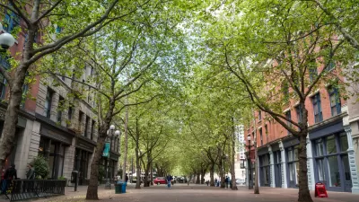
Seattle provides plenty of shade for residents to enjoy in the summer months.
Charles Mudede takes a dive into the world of urban tree canopies, comparing Seattle's urban forest to cities around the world and finding that the Pacific Northwest City is pretty green.
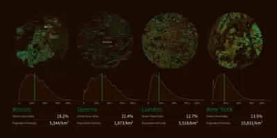
According to Treepedia, the density of Seattle's forest is second only to Sacramento's in the US. Vancouver BC, which is up in Canada and the second-largest city in the Pacific Northwest, has a denser forest than Seattle's.
Mudede also cites a 2012 report called "Forest Ecosystem Values: Analysis of the Structure, Function, and Economic Benefits," to place the number of trees in Seattle at 4.35 trees and tree-like shrubs. That's 7 trees and tree-like shrubs for every resident in Seattle. Mudede also explains the loose definition of "tree" (hence all the "tree-like shrubs")—it might come as a surprise to amateur biologists that there "is no hard science to tree-ness."
Treepedia is also worth another look. The project by the MIT Senseable City Lab uses Google Street View data to measure the urban "Green Canopy," or the aboveground portion of trees and vegetation in cities around the world. Planetizen covered the public release of Treepedia at the beginning of 2017.
FULL STORY: Seattle Is the Seventh-Densest City In the World—For Trees

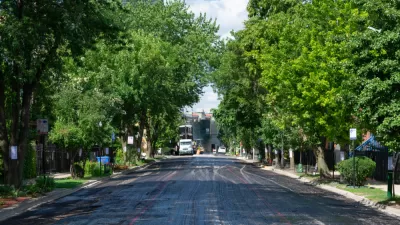
How To Preserve Both Affordable Housing and Urban Trees
Housing and environmental activists are calling on the city to commit to a ‘Trees and’ approach, rejecting the perceived conflict between housing affordability and a healthy urban tree canopy.
A New Study Asserts the Importance of Urban Trees in Conservation Efforts
Data collected from 13 million tree planting records in 473 urban areas across 73 countries provides insight into the role of urban trees in biodiversity conservation.
Chicago Was Already Wiping Out Trees. Then the Derecho Hit.
An Urban Forestry Board is needed in Chicago to unsure the health and safety benefits of a flourishing urban forest.

Planetizen Federal Action Tracker
A weekly monitor of how Trump’s orders and actions are impacting planners and planning in America.

Map: Where Senate Republicans Want to Sell Your Public Lands
For public land advocates, the Senate Republicans’ proposal to sell millions of acres of public land in the West is “the biggest fight of their careers.”

Restaurant Patios Were a Pandemic Win — Why Were They so Hard to Keep?
Social distancing requirements and changes in travel patterns prompted cities to pilot new uses for street and sidewalk space. Then it got complicated.

Platform Pilsner: Vancouver Transit Agency Releases... a Beer?
TransLink will receive a portion of every sale of the four-pack.

Toronto Weighs Cheaper Transit, Parking Hikes for Major Events
Special event rates would take effect during large festivals, sports games and concerts to ‘discourage driving, manage congestion and free up space for transit.”

Berlin to Consider Car-Free Zone Larger Than Manhattan
The area bound by the 22-mile Ringbahn would still allow 12 uses of a private automobile per year per person, and several other exemptions.
Urban Design for Planners 1: Software Tools
This six-course series explores essential urban design concepts using open source software and equips planners with the tools they need to participate fully in the urban design process.
Planning for Universal Design
Learn the tools for implementing Universal Design in planning regulations.
Heyer Gruel & Associates PA
JM Goldson LLC
Custer County Colorado
City of Camden Redevelopment Agency
City of Astoria
Transportation Research & Education Center (TREC) at Portland State University
Camden Redevelopment Agency
City of Claremont
Municipality of Princeton (NJ)