


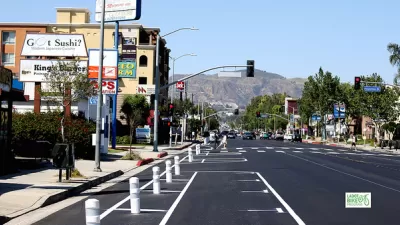
A staple of the California driving experience will soon be a thing of the past.

"Botts’ Dots – the raised, rumbly markers between lanes on California’s highways and freeways – are on their way out, with Caltrans saying it will no longer maintain or install them," reports Jonathan Winslow.
Botts' Dots are named for Elbert Dysart Botts, whose research in the 1950s led to the long-term implementation of the dots, both in California and around the country.
The old technology is now being phased out, on the recommendation of federal transit officials (usually issues of pavement markings comes under the purview of the Federal Highway Administration). "Critics say the ceramic buttons aren’t reflective, don’t really help that much, mess up autonomous cars and don’t last very long," according to Winslow.
Winslow is able to find at least one driver who credits the rumble created by the raised dots from keeping them alert while driving. The state, however, has found little evidence to dispute the opinions of the feds on the matter.
There remain 20 million dots on California highways and freeways, and they'll be allowed to slowly disappear, though some cities will still use them, according to Winslow.
For more on the demise of Botts' Dots, see also coverage by Gary Richards in February and Tony Bizjak in January.
FULL STORY: Botts’ Dots, after a half-century, will disappear from California freeways, highways

Caltrans Releases Complete Streets Action Plan
The agency’s detailed list of actions highlights the many changes needed to truly implement Complete Streets principles into California road construction and maintenance.

Vehicle-related Deaths Drop 29% in Richmond, VA
The seventh year of the city's Vision Zero strategy also cut the number of people killed in alcohol-related crashes by half.

Maryland Plans Quick-Build Complete Streets Projects
The state will use low-cost interventions to improve road safety in five Maryland counties.

Planetizen Federal Action Tracker
A weekly monitor of how Trump’s orders and actions are impacting planners and planning in America.

San Francisco's School District Spent $105M To Build Affordable Housing for Teachers — And That's Just the Beginning
SFUSD joins a growing list of school districts using their land holdings to address housing affordability challenges faced by their own employees.

The Tiny, Adorable $7,000 Car Turning Japan Onto EVs
The single seat Mibot charges from a regular plug as quickly as an iPad, and is about half the price of an average EV.

San Diego Votes to Rein in “Towering” ADUs
City council voted to limit the number of units in accessory buildings to six — after confronting backyard developments of up to 100 units behind a single family home.

Texas Legislature’s Surprising Pro-Housing Swing
Smaller homes on smaller lots, office to apartment conversions, and 40% less say for NIMBYs, vote state lawmakers.

Even Edmonton Wants Single Staircase Buildings
Canada's second most affordable major city joins those angling to nix the requirement for two staircases in multi-family buildings.
Urban Design for Planners 1: Software Tools
This six-course series explores essential urban design concepts using open source software and equips planners with the tools they need to participate fully in the urban design process.
Planning for Universal Design
Learn the tools for implementing Universal Design in planning regulations.
Borough of Carlisle
Smith Gee Studio
City of Camden Redevelopment Agency
City of Astoria
Transportation Research & Education Center (TREC) at Portland State University
City of Camden Redevelopment Agency
Municipality of Princeton (NJ)