


Instead of a disused rail line, Seoul will repurpose one of its many old overpasses. The goal is to introduce green space and build up connective pedestrian infrastructure.
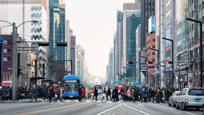
This week, the South Korean capital will open Seoullo 7017, a High Line-evoking pedestrian park built on a mile of elevated highway. Anna Fifield writes: "After it emerged from the Korean War, Seoul was rebuilt almost in the blink of an eye as South Korea began its transformation into an economic powerhouse. Starting in the 1960s, city planners ordered the construction of dozens of elevated highways to keep traffic flowing through the capital."
FULL STORY: Seoul, a city ‘with no soul,’ builds its own High Line on an old overpass


Around the World, Cities Imitate the High Line
The High Line's brand of urban reinvention has caught on, sparking a number of similar projects throughout the world. In addition to disused rail, many projects repurpose old road infrastructure.
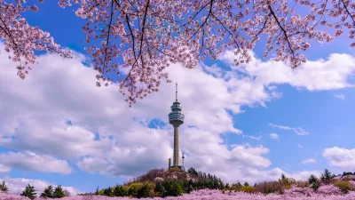
Seoul’s Urban Parks Blossom with Books
The Reading in Seoul Garden event invited residents to enjoy free reading and relaxation activities, including digital and live programs, in scenic parks, fostering a sense of community amid the city’s autumn landscapes.

Tokyo Expressway to Become a Linear Park
A major expressway in Ginza will be converted to a park similar to New York City's High Line.

Planetizen Federal Action Tracker
A weekly monitor of how Trump’s orders and actions are impacting planners and planning in America.

Map: Where Senate Republicans Want to Sell Your Public Lands
For public land advocates, the Senate Republicans’ proposal to sell millions of acres of public land in the West is “the biggest fight of their careers.”

Restaurant Patios Were a Pandemic Win — Why Were They so Hard to Keep?
Social distancing requirements and changes in travel patterns prompted cities to pilot new uses for street and sidewalk space. Then it got complicated.

Platform Pilsner: Vancouver Transit Agency Releases... a Beer?
TransLink will receive a portion of every sale of the four-pack.

Toronto Weighs Cheaper Transit, Parking Hikes for Major Events
Special event rates would take effect during large festivals, sports games and concerts to ‘discourage driving, manage congestion and free up space for transit.”

Berlin to Consider Car-Free Zone Larger Than Manhattan
The area bound by the 22-mile Ringbahn would still allow 12 uses of a private automobile per year per person, and several other exemptions.
Urban Design for Planners 1: Software Tools
This six-course series explores essential urban design concepts using open source software and equips planners with the tools they need to participate fully in the urban design process.
Planning for Universal Design
Learn the tools for implementing Universal Design in planning regulations.
Heyer Gruel & Associates PA
JM Goldson LLC
Custer County Colorado
City of Camden Redevelopment Agency
City of Astoria
Transportation Research & Education Center (TREC) at Portland State University
Camden Redevelopment Agency
City of Claremont
Municipality of Princeton (NJ)