


Just in time for United Nations World Wildlife Day, a new initiative in Israel has launched to identify deadly road crossings for animals by harnessing data collected from the Waze app.
Waze and the Society for the Protection of Nature in Israel (SPNI) have partnered in support of wildlife by using the Waze app's roadkill button to identify areas where animal deaths are occurring at higher rates. Sharon Udasin of The Jerusalem Post reports that the data collected will help to identify areas where wildlife are threatened by vehicles and give SPNI an opportunity to create solutions for their safe movement.
Shmulik Yidov, head of SPNI's Mammal Center, notes that in addition to reducing the number of animal deaths, they are trying to solve the problems created by roadways that fragment animal populations, "creating demographic and genetic diversity problems in the long-term."
With the data generated, the organization will be creating a "Red Road Atlas for Wildlife" and taking action to regulate safe crosswalks for animals. Through both observation and the use of surveillance cameras in problematic areas, SPNI representatives said they hope to deepen their understanding as to why these animals are being run over and what steps can be taken to minimize the number of deaths.
FULL STORY: Waze and SPNI team up to prevent wildlife from becoming roadkill

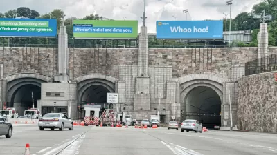
Waze Outfits NYC Tunnels with Beacons for Underground Navigation
The tech is part of a public-private partnership meant to improve connectivity to Waze and other navigation apps from underground.
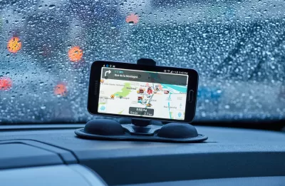
Cities Seeking New Weapons in the Battle Against Waze-Induced Traffic
Los Altos, California has erected a new roadblock in its ongoing effort to keep drivers from cutting through residential neighborhoods, beckoned by the popular navigation app Waze.

There's No App for Silver Bullets
Two planning researchers, one a professor at Tufts and another independent, make the case against apps as a panacea for urban problems.

Planetizen Federal Action Tracker
A weekly monitor of how Trump’s orders and actions are impacting planners and planning in America.

Map: Where Senate Republicans Want to Sell Your Public Lands
For public land advocates, the Senate Republicans’ proposal to sell millions of acres of public land in the West is “the biggest fight of their careers.”

Restaurant Patios Were a Pandemic Win — Why Were They so Hard to Keep?
Social distancing requirements and changes in travel patterns prompted cities to pilot new uses for street and sidewalk space. Then it got complicated.

California Homeless Arrests, Citations Spike After Ruling
An investigation reveals that anti-homeless actions increased up to 500% after Grants Pass v. Johnson — even in cities claiming no policy change.

Albuquerque Route 66 Motels Become Affordable Housing
A $4 million city fund is incentivizing developers to breathe new life into derelict midcentury motels.

DC Area County Eliminates Bus Fares
Montgomery County joins a growing trend of making transit free.
Urban Design for Planners 1: Software Tools
This six-course series explores essential urban design concepts using open source software and equips planners with the tools they need to participate fully in the urban design process.
Planning for Universal Design
Learn the tools for implementing Universal Design in planning regulations.
Heyer Gruel & Associates PA
JM Goldson LLC
Custer County Colorado
City of Camden Redevelopment Agency
City of Astoria
Transportation Research & Education Center (TREC) at Portland State University
Camden Redevelopment Agency
City of Claremont
Municipality of Princeton (NJ)