


A new study explores how the built environment influences vehicle miles traveled.

New research based in Massachusetts suggests policy action in six areas to reduce driving in the state—none of which include widening roads.
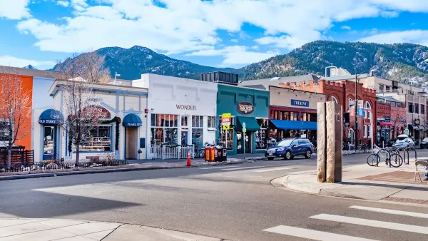
Instead, researchers at the State Smart Transportation Initiative have identified characteristics of development that factor into vehicle miles traveled:
- Land use mix (average distance between homes and the nearest retail establishment)
- Household density (households per square mile of land area)
- Sidewalk coverage (percentage of road miles with a sidewalk at least 3 feet in width)
- Transit access (average distance between homes and the nearest transit stop)
- Intersection density (number of intersections per square mile)
- Managed parking (block groups with a single-use parking structure within 1 mile scored 1, others scored 0)
"The only policy options expected to reduce 2040 passenger VMT below 2010 levels involved changes to all six variables," writes SSTI's Bill Holloway. "However, policies that adjust only a single variable could also make a significant difference."
The largest impact of any single policy change would come from increasing land use mix, which could reduce VMT by 4.3 percent.
"Siting stores and other destinations within walking distance of where people live is one of the most powerful ways to reduce car traffic," Streetsblog explains.
FULL STORY: A Six-Point Plan to Cut Traffic

Boulder Eliminates Parking Minimums Citywide
Officials estimate the cost of building a single underground parking space at up to $100,000.

Washington State Legislature Passes Parking Reform Bill
A bill that would limit parking requirements for new developments is headed to the governor’s desk.

Opinion: California’s SB 79 Would Improve Housing Affordability and Transit Access
A proposed bill would legalize transit-oriented development statewide.

Planetizen Federal Action Tracker
A weekly monitor of how Trump’s orders and actions are impacting planners and planning in America.

Maui's Vacation Rental Debate Turns Ugly
Verbal attacks, misinformation campaigns and fistfights plague a high-stakes debate to convert thousands of vacation rentals into long-term housing.

Restaurant Patios Were a Pandemic Win — Why Were They so Hard to Keep?
Social distancing requirements and changes in travel patterns prompted cities to pilot new uses for street and sidewalk space. Then it got complicated.

In California Battle of Housing vs. Environment, Housing Just Won
A new state law significantly limits the power of CEQA, an environmental review law that served as a powerful tool for blocking new development.

Boulder Eliminates Parking Minimums Citywide
Officials estimate the cost of building a single underground parking space at up to $100,000.

Orange County, Florida Adopts Largest US “Sprawl Repair” Code
The ‘Orange Code’ seeks to rectify decades of sprawl-inducing, car-oriented development.
Urban Design for Planners 1: Software Tools
This six-course series explores essential urban design concepts using open source software and equips planners with the tools they need to participate fully in the urban design process.
Planning for Universal Design
Learn the tools for implementing Universal Design in planning regulations.
Heyer Gruel & Associates PA
JM Goldson LLC
Custer County Colorado
City of Camden Redevelopment Agency
City of Astoria
Transportation Research & Education Center (TREC) at Portland State University
Jefferson Parish Government
Camden Redevelopment Agency
City of Claremont