


Schools tend to get built on cheap land. Cheap land is often found near busy roadways—sources of pollutants that are harmful to the health of children.
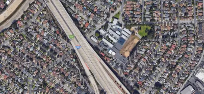
"Nearly 8,000 U.S. public schools lie within 500 feet of highways, truck routes and other roads with significant traffic," reports Jamie Smith Hopkins, who is sharing the findings of a joint investigation by the Center for Public Integrity and Reveal from The Center for Investigative Reporting.
Put another way, "[t]hat’s about one in every 11 public schools, serving roughly 4.4 million students and spread across every state in the nation."
According to Smith Hopkins, schools across the country continue to be located neat polluting roadways despite warnings against the practice. In fact, "[n]early one in five schools that opened in the 2014-2015 school year, the most recent the federal government has fully tracked, was built by a busy road."
The article also notes that the state of California and the U.S. Environmental Protection Agency have provided leadership on the ensuring healthier air for school environments. For instance, the U.S. EPA released the "Best Practices for Reducing Near Road Pollution Exposure at Schools" in 2015.
FULL STORY: The invisible hazard afflicting thousands of schools

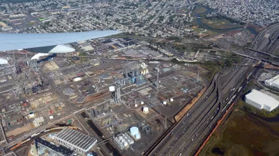
Comment: EPA Cuts will Send Atlanta Back to Eye-burning Ozone, Lung-damaging Smog, and Raw Sewage in the Chattahoochee River
A veteran political journalist takes stock of the hard-earned ground Georgia stands to lose with slashed environmental protection.
New Jersey to Consider Charging Fossil Fuel Companies for Pollution
A proposed law would make companies liable for damages caused by burning fossil fuels.
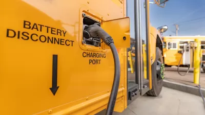
Opinion: Supporting Electric School Buses is the Right Thing to Do — and Fiscally Conservative
Why switching school bus fleets to electric vehicles is good for students, the environment, and school districts’ finances.

Planetizen Federal Action Tracker
A weekly monitor of how Trump’s orders and actions are impacting planners and planning in America.

Restaurant Patios Were a Pandemic Win — Why Were They so Hard to Keep?
Social distancing requirements and changes in travel patterns prompted cities to pilot new uses for street and sidewalk space. Then it got complicated.

Map: Where Senate Republicans Want to Sell Your Public Lands
For public land advocates, the Senate Republicans’ proposal to sell millions of acres of public land in the West is “the biggest fight of their careers.”

Maui's Vacation Rental Debate Turns Ugly
Verbal attacks, misinformation campaigns and fistfights plague a high-stakes debate to convert thousands of vacation rentals into long-term housing.

San Francisco Suspends Traffic Calming Amidst Record Deaths
Citing “a challenging fiscal landscape,” the city will cease the program on the heels of 42 traffic deaths, including 24 pedestrians.

California Homeless Arrests, Citations Spike After Ruling
An investigation reveals that anti-homeless actions increased up to 500% after Grants Pass v. Johnson — even in cities claiming no policy change.
Urban Design for Planners 1: Software Tools
This six-course series explores essential urban design concepts using open source software and equips planners with the tools they need to participate fully in the urban design process.
Planning for Universal Design
Learn the tools for implementing Universal Design in planning regulations.
Heyer Gruel & Associates PA
JM Goldson LLC
Custer County Colorado
City of Camden Redevelopment Agency
City of Astoria
Transportation Research & Education Center (TREC) at Portland State University
Camden Redevelopment Agency
City of Claremont
Municipality of Princeton (NJ)