


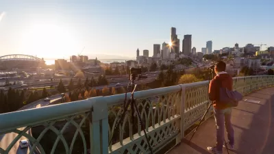
The city of Seattle is moving through the planning and design stages on two important bike infrastructure projects located at the south end of Downtown.
Ryan Packer analyzes two separate but proximate bike infrastructure projects proposed for Seattle—both intended to connect to the city's larger bike network.
The first project would add a protected bike lane on South Dearborn Street, a projected complicated by its passage underneath the I-5 Freeway, which necessitates the participation of the Washington State Department of Transportation.
Construction is slated to begin this spring on the area west of I-5, all the way to 6th Ave S. In the summer, crews will put down a pilot protected bike lane between the west side of I-5 and Rainier Avenue. This will allow SDOT to see how the protected bike lane works before summer 2018, when Dearborn is repaved between Rainier and the east side of I-5 and the bike lane has to be redone with the rest of the street.
The many spatial details of the projects, along with its many complications, is informative of the challenges of implementing bike infrastructure on existing streets.
The second project, the King Street Greenway, is expected for construction in 2018. The neighborhood greenway will pass through the International District at the south end of Downtown Seattle. "King Street greenway will bring the Seattle greenways program into a different sort of territory: a wholly urban one," explains Packer of the significance of the project.
FULL STORY: Planning Safe Connections To South Downtown

A Thorough, Mixed Review for a New Protected Bike Lane in Seattle
So many highly anticipated bike facilities finally deliver only to fall short of real game changing status. Seattle provides the latest example of the phenomenon in the wild.
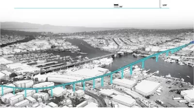
Seattle Ponders Improvements to Ballard Bridge for All Modes of Transport
The Seattle Department of Transportation (SDOT) is in the midst of a planning study on Ballard Bridge, soliciting feedback from the community about how to improve circulation of vehicles and pedestrians.
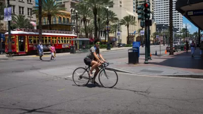
New Orleans Seeking Funds for Big Protected Bike Lane Plans
With a $2.6 million grant already in hand to research the process of planning and developing protected bikes, the city of New Orleans is seeking more funding in the hopes of adding 75 miles of protected bike lanes.

Maui's Vacation Rental Debate Turns Ugly
Verbal attacks, misinformation campaigns and fistfights plague a high-stakes debate to convert thousands of vacation rentals into long-term housing.

Planetizen Federal Action Tracker
A weekly monitor of how Trump’s orders and actions are impacting planners and planning in America.

San Francisco Suspends Traffic Calming Amidst Record Deaths
Citing “a challenging fiscal landscape,” the city will cease the program on the heels of 42 traffic deaths, including 24 pedestrians.

Defunct Pittsburgh Power Plant to Become Residential Tower
A decommissioned steam heat plant will be redeveloped into almost 100 affordable housing units.

Trump Prompts Restructuring of Transportation Research Board in “Unprecedented Overreach”
The TRB has eliminated more than half of its committees including those focused on climate, equity, and cities.

Amtrak Rolls Out New Orleans to Alabama “Mardi Gras” Train
The new service will operate morning and evening departures between Mobile and New Orleans.
Urban Design for Planners 1: Software Tools
This six-course series explores essential urban design concepts using open source software and equips planners with the tools they need to participate fully in the urban design process.
Planning for Universal Design
Learn the tools for implementing Universal Design in planning regulations.
Heyer Gruel & Associates PA
JM Goldson LLC
Custer County Colorado
City of Camden Redevelopment Agency
City of Astoria
Transportation Research & Education Center (TREC) at Portland State University
Jefferson Parish Government
Camden Redevelopment Agency
City of Claremont