


An exploration, historical and geographic, of St. Paul's Wheelock Parkway reveals the twists and turns of transportation infrastructure.
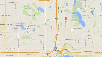
Andy Sturdevant asks the question on the mind of plenty of people in the Twin Cities region: " Why does Wheelock Parkway exist?" Wheelock Parkway is that circuitous route connecting St. Paul's largest lake, Phalen to its second-largest, Como.
According to Studevent, the parkway "seems like a useful recreational route, but it doesn’t follow any sort of logical path to get there. It staggers across the orderly gridded streets of St. Paul like a tipsy barfly weaving around tables and chairs on his way back up to the bar."
Thus, the article digs into the history of the parkway, laid out in 1909, and its place as a "once and future keystone of the Grand Round trail system…" The article is part history and part celebration of one of a unique cities idiosyncrasies.
FULL STORY: Wheelock Parkway: St. Paul's hidden passageway from Phalen to Como

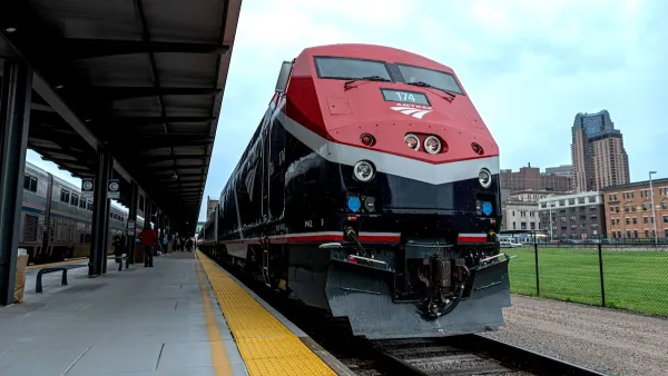
Amtrak’s Borealis Exceeds First Year Ridership Expectations
205,800 passengers have boarded the St. Paul to Chicago line, well above initial MDOT projections.

Looking Back on 60 Years of Land Development in the Twin Cities
In 1960, about 12 percent of the Twin Cities metro's land was already developed. By 2020, about 34 percent had been developed. Many factors influenced how the region has changed since 1960.

Amtrak Borealis Line Celebrates 100,000 Passengers
The St. Paul-to-Chicago train served more than 22,000 passengers in August.

Planetizen Federal Action Tracker
A weekly monitor of how Trump’s orders and actions are impacting planners and planning in America.

Maui's Vacation Rental Debate Turns Ugly
Verbal attacks, misinformation campaigns and fistfights plague a high-stakes debate to convert thousands of vacation rentals into long-term housing.

Restaurant Patios Were a Pandemic Win — Why Were They so Hard to Keep?
Social distancing requirements and changes in travel patterns prompted cities to pilot new uses for street and sidewalk space. Then it got complicated.

In California Battle of Housing vs. Environment, Housing Just Won
A new state law significantly limits the power of CEQA, an environmental review law that served as a powerful tool for blocking new development.

Boulder Eliminates Parking Minimums Citywide
Officials estimate the cost of building a single underground parking space at up to $100,000.

Orange County, Florida Adopts Largest US “Sprawl Repair” Code
The ‘Orange Code’ seeks to rectify decades of sprawl-inducing, car-oriented development.
Urban Design for Planners 1: Software Tools
This six-course series explores essential urban design concepts using open source software and equips planners with the tools they need to participate fully in the urban design process.
Planning for Universal Design
Learn the tools for implementing Universal Design in planning regulations.
Heyer Gruel & Associates PA
JM Goldson LLC
Custer County Colorado
City of Camden Redevelopment Agency
City of Astoria
Transportation Research & Education Center (TREC) at Portland State University
Jefferson Parish Government
Camden Redevelopment Agency
City of Claremont