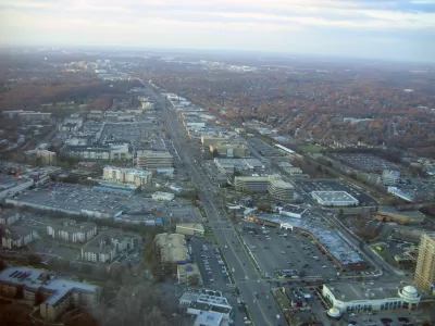
Rockville, Maryland has plans to create a king-sized complete street along Rockville Pike, incorporating lanes for cars, bikes, buses, and more space for landscaping. But can a street like that still serve pedestrians?

Rockville Pike is a high-traffic thoroughfare and a prime candidate for complete streets upgrades. But Dan Malouff sees trouble in the city's current plan to build a mega-complete street with "12 car lanes, 4 bike lanes, 2 bus lanes, and over 50 feet of landscaping."
From the article: "At first glance, this plan has all the components of a good complete street design: Tree-lined sidwalks, protected bikeways, a center-running dedicated busway. Every mode gets all the street width it could possibly want." Except, Malouff argues, the very pedestrians complete streets are supposed to prioritize.
By over-delivering on the accessories to walkability, the Rockville Pike plan may undermine its original intent. "Transit oriented development doesn't work unless it's walkable. If Rockville Pike is too wide, development on one side of the street will be effectively cut-off from development on the other side. Riders won't be able to easily access the BRT stations. People will drive for even short trips. The concept of a community where people don't need to drive everywhere will break down."
FULL STORY: Rockville misses the forest for the trees with its plan for an 18-lane mega main street

Maui's Vacation Rental Debate Turns Ugly
Verbal attacks, misinformation campaigns and fistfights plague a high-stakes debate to convert thousands of vacation rentals into long-term housing.

Planetizen Federal Action Tracker
A weekly monitor of how Trump’s orders and actions are impacting planners and planning in America.

In Urban Planning, AI Prompting Could be the New Design Thinking
Creativity has long been key to great urban design. What if we see AI as our new creative partner?

Florida Seniors Face Rising Homelessness Risk
High housing costs are pushing more seniors, many of them on a fixed income, into homelessness.

Massachusetts Budget Helps Close MBTA Budget Gap
The budget signed by Gov. Maura Healey includes $470 million in MBTA funding for the next fiscal year.

Milwaukee Launches Vision Zero Plan
Seven years after the city signed its Complete Streets Policy, the city is doubling down on its efforts to eliminate traffic deaths.
Urban Design for Planners 1: Software Tools
This six-course series explores essential urban design concepts using open source software and equips planners with the tools they need to participate fully in the urban design process.
Planning for Universal Design
Learn the tools for implementing Universal Design in planning regulations.
Gallatin County Department of Planning & Community Development
Heyer Gruel & Associates PA
JM Goldson LLC
City of Camden Redevelopment Agency
City of Astoria
Transportation Research & Education Center (TREC) at Portland State University
Jefferson Parish Government
Camden Redevelopment Agency
City of Claremont


