


OpenGrid gathers together Chicago's open data, letting users specify areas of focus on a map of the city. Users can also overlay different datasets on the same map.

Chicago's open data community have already created tools to curate what the city makes public. OpenGrid is an effort by the city to collect that data and make it more accessible. Whet Moser writes, "It's an interface for the city's open data that allows users to run their searches off a map, creating their own geographies as they go and mashing up data as they wish."
Prior to OpenGrid, the city used a similar tool called WindyGrid to help plan events, services, and public safety. "With backing from Bloomberg Philanthropies and hosting by the Smart Chicago Collaborative, the city built a public version—OpenGrid—atop Plenar.io, an open-source infrastructure for open data."
Brenna Berman, Chicago's chief information officer, sees OpenGrid as a way for researchers to define neighborhoods and communities independently from official distinctions. "'Lots of people, the neighborhood that they recognize is not in their ward or community area,' Berman says. 'The polygon that I'd draw crosses two wards and community areas. These formal things are not where we live.'"
FULL STORY: Want Chicago Data? OpenGrid Makes It Easier Than Ever

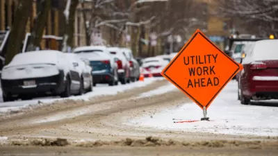
A Website to Report and Map Street Repair Work
The ChiSreetWork website, which updates the location of street repairs and was originally intended for internal use at City Hall, is now publicly available in Chicago.

First City to Make Ride-Hailing Trip Data Public: Chicago
Data geeks in Chicago will get the first chance to crunch detailed data on transportation network company trips in their city.

DataUSA: An Intuitive Tool for Public Data
A collaboration between Deloitte, Datawheel, and MIT has produced an intuitive aesthetically-pleasing gathering point for public data in the United States. Specific locations and industries boast easy-to-read profiles.

Planetizen Federal Action Tracker
A weekly monitor of how Trump’s orders and actions are impacting planners and planning in America.

Congressman Proposes Bill to Rename DC Metro “Trump Train”
The Make Autorail Great Again Act would withhold federal funding to the system until the Washington Metropolitan Area Transit Authority (WMATA), rebrands as the Washington Metropolitan Authority for Greater Access (WMAGA).

DARTSpace Platform Streamlines Dallas TOD Application Process
The Dallas transit agency hopes a shorter permitting timeline will boost transit-oriented development around rail stations.

Renters Now Outnumber Homeowners in Over 200 US Suburbs
High housing costs in city centers and the new-found flexibility offered by remote work are pushing more renters to suburban areas.

The Tiny, Adorable $7,000 Car Turning Japan Onto EVs
The single seat Mibot charges from a regular plug as quickly as an iPad, and is about half the price of an average EV.

Supreme Court Ruling in Pipeline Case Guts Federal Environmental Law
The decision limits the scope of a federal law that mandates extensive environmental impact reviews of energy, infrastructure, and transportation projects.
Urban Design for Planners 1: Software Tools
This six-course series explores essential urban design concepts using open source software and equips planners with the tools they need to participate fully in the urban design process.
Planning for Universal Design
Learn the tools for implementing Universal Design in planning regulations.
Municipality of Princeton
Roanoke Valley-Alleghany Regional Commission
City of Mt Shasta
City of Camden Redevelopment Agency
City of Astoria
Transportation Research & Education Center (TREC) at Portland State University
US High Speed Rail Association
City of Camden Redevelopment Agency
Municipality of Princeton (NJ)