


Based out of San Francisco, Remix is an intuitive, data-rich tool for transit planners as they consider new routes. All you need to do is draw out the line on a map and add stops.
For Next City, Josh Cohen reports on Remix, a software company developing a comprehensive tool for transit planners. "The software allows planners to draw new transit routes on a map and receive a litany of data such as cost and population in real time." The aim is to combine the functions of separate tools like Google Maps, ArcGIS, and Excel into one platform.
The tool started out as the brainchild of Code for America fellows Tiffany Chu and Sam Hashemi, then called TransitMix. "It was essentially a game meant to help people see the costs and challenges of creating new bus lines, but Chu and Hashemi started hearing from planners who were using TransitMix professionally."
Remix uses open source data in its effort to streamline the planning process. "In Remix, planners draw out a new or modified bus line on a map, clicking to add new stops. As they do, the program provides real-time schedule information, data about the number of residents the line would serve, the number of buses needed to serve the line and costs. When you make a modification to the line, the data changes in real time."
FULL STORY: Transit Planning Is Getting Faster

New Bus Only Lane Overcomes Opposition in San Francisco
Local business owners and the local elected official opposed the Geary transit-only lane project, but compromise and wide public support got the project across the finish line.

Long Delayed, $1.95 Billion Central Subway Opens in San Francisco
San Francisco’s first north-south subway opened last weekend, extending service on Muni’s T light rail line.
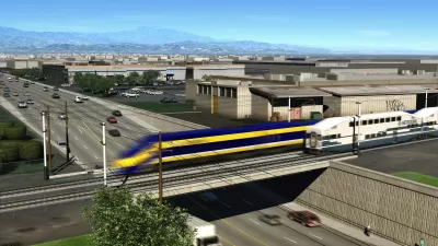
California High-Speed Rail Recommits to Bakersfield-to-Merced Segment
The California High-Speed Rail Authority also certified the Final Environmental Impact Report/Environmental Impact Statement for the San Francisco to San Jose section of the route in August.

Montreal Mall to Become 6,000 Housing Units
Place Versailles will be transformed into a mixed-use complex over the next 25 years.

Planetizen Federal Action Tracker
A weekly monitor of how Trump’s orders and actions are impacting planners and planning in America.

DARTSpace Platform Streamlines Dallas TOD Application Process
The Dallas transit agency hopes a shorter permitting timeline will boost transit-oriented development around rail stations.

Without International Immigrants, the Rural US Population Would Be Falling 58%
Census data shows that population growth in rural areas is due in large part to international migrants.

Dead End: Nine Highways Ready for Retirement
The Freeways Without Futures report describes the nation’s most promising highway removal proposals.

Congressman Proposes Bill to Rename DC Metro “Trump Train”
The Make Autorail Great Again Act would withhold federal funding to the system until the Washington Metropolitan Area Transit Authority (WMATA), rebrands as the Washington Metropolitan Authority for Greater Access (WMAGA).
Urban Design for Planners 1: Software Tools
This six-course series explores essential urban design concepts using open source software and equips planners with the tools they need to participate fully in the urban design process.
Planning for Universal Design
Learn the tools for implementing Universal Design in planning regulations.
City of Mt Shasta
City of Camden Redevelopment Agency
City of Astoria
Transportation Research & Education Center (TREC) at Portland State University
City of Camden Redevelopment Agency
Municipality of Princeton (NJ)
Regional Transportation Commission of Southern Nevada