


The Mapillary app allows users to upload their street-level photos into a geo-tagged sequence.
The crowdsourcing app Mapillary just completed its "Mapillary Walk" competition, in the process collecting and sharing foot-level photos from beautiful locations around the world.
The Mappillary viewer animates these photo collections to provide a level of virtual geographic reality to locations through remote computer screens.
The power of the Mapillary technology is apparent in the top entries the competition: locations in the Algonquin Provincial Park in Canada and the Måryd Nature Reserve in Sweden finished in first and second, respectively. Locations in Fukushima in Japan and Madeira Island in Portugal tied for third.
Click here to see the Mapillary viewer experience of the Algonquin Provincial Park in Canada. Once in the viewer, click through the photos in sequence or jump to different locations on the map. In addition to these winners, the Mapillary collection includes 45,819,972 photos, as of this writing, covering 1,201,041.8 kilometers.
FULL STORY: Mapillary Walk Wrap Up


Friday Eye Candy: AI Envisions Solutions to the Challenges Facing Cities
Phoenix reimagined for shade. Los Angeles as a place where everybody walks. San Francisco with affordable housing. AI makes a vision of the future possible.

Friday Eye Candy: 20 AI-Generated Cityscapes
AI-generated images are creating new landscapes and cityscapes, capable of inspiring awe or fear.
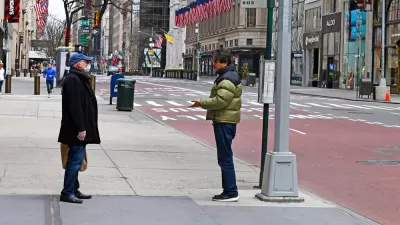
Friday Eye Candy: Covid-19, Then and Now
The New York Times compared images from readers portraying similar scenes in 2020 and 2022.

Planetizen Federal Action Tracker
A weekly monitor of how Trump’s orders and actions are impacting planners and planning in America.

Map: Where Senate Republicans Want to Sell Your Public Lands
For public land advocates, the Senate Republicans’ proposal to sell millions of acres of public land in the West is “the biggest fight of their careers.”

Restaurant Patios Were a Pandemic Win — Why Were They so Hard to Keep?
Social distancing requirements and changes in travel patterns prompted cities to pilot new uses for street and sidewalk space. Then it got complicated.

California Homeless Arrests, Citations Spike After Ruling
An investigation reveals that anti-homeless actions increased up to 500% after Grants Pass v. Johnson — even in cities claiming no policy change.

Albuquerque Route 66 Motels Become Affordable Housing
A $4 million city fund is incentivizing developers to breathe new life into derelict midcentury motels.

DC Area County Eliminates Bus Fares
Montgomery County joins a growing trend of making transit free.
Urban Design for Planners 1: Software Tools
This six-course series explores essential urban design concepts using open source software and equips planners with the tools they need to participate fully in the urban design process.
Planning for Universal Design
Learn the tools for implementing Universal Design in planning regulations.
Heyer Gruel & Associates PA
JM Goldson LLC
Custer County Colorado
City of Camden Redevelopment Agency
City of Astoria
Transportation Research & Education Center (TREC) at Portland State University
Camden Redevelopment Agency
City of Claremont
Municipality of Princeton (NJ)