


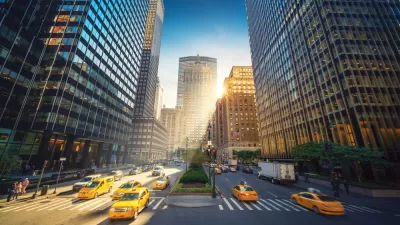
Perkins Eastman has created a splashy proposal for a linear, at-grade park running along a long stretch of one of New York's most famous avenues.
Alan G. Brake details a highly conceptual proposal that would "would see New York's iconic Broadway converted into a linear park running from Columbus Circle to Union Square." The architecture firm Perkins Eastman created the proposal, citing the benefits to pedestrians and cyclists, as well as to the city's stormwater infrastructure. "Based on the success of the High Line, the designers argue the proposal would increase property values and therefore would pay for itself," adds Brake.
Brake also notes that New York City is experiencing a bit of a park design moment riding on the heels of the High Line's success. Design proposals for the Lowline, the Big U around Lower Manhattan, and a $170 million proposal to makeover Pier 54.
The news caught the attention of other urban design-focused publications. Kriston Capps writes for CityLab that the proposal combines two of the "best-loved" land use projects of the Bloomberg era in New York City: the High Line and closing Times Square to cars.
Writing for The Architect's Newspaper, Audrey Wachs notes the project's "Bilbao Effect" ambitions (i.e., "culture-led revitalization of a postindustrial city driven by a single institution housed in a starchitect-designed complex…").
FULL STORY: Perkins Eastman proposes turning New York's Broadway into one long park

The Once and Future Park Avenue Promenade
The debate about whether the pedestrian-oriented changes made to the New York City streetscape during the pandemic should be permanent has a high-profile battleground on Park Avenue.
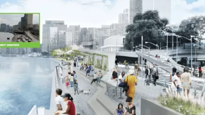
Court Decision Clears the Way for East River Greenway Bike Bridge
A community group had sued to prevent the construction of a bridge in Clara Coffey Park in New York City. The court ruled in the favor of the city's plans.
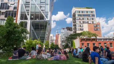
Ten Years of the High Line—Time to Reflect
As the High Line turns ten, a debate about the costs and benefits of urban revitalization continues.

Montreal Mall to Become 6,000 Housing Units
Place Versailles will be transformed into a mixed-use complex over the next 25 years.

Planetizen Federal Action Tracker
A weekly monitor of how Trump’s orders and actions are impacting planners and planning in America.

DARTSpace Platform Streamlines Dallas TOD Application Process
The Dallas transit agency hopes a shorter permitting timeline will boost transit-oriented development around rail stations.

Interactive Map Reveals America's “Shade Deserts”
Launched by UCLA and American Forests to combat heat-related deaths, the tool maps the shade infrastructure for over 360 U.S. cities.

Bicycles and Books — In Sacramento, Libraries Now Offer Both
Adult library card holders can check out e-bikes and e-trikes for up to one week.

Colorado Landfills Emit as Much Pollution as 1M Cars
Landfills are the third-largest source of methane pollution in Colorado, after agriculture and fossil fuel extraction.
Urban Design for Planners 1: Software Tools
This six-course series explores essential urban design concepts using open source software and equips planners with the tools they need to participate fully in the urban design process.
Planning for Universal Design
Learn the tools for implementing Universal Design in planning regulations.
City of Mt Shasta
City of Camden Redevelopment Agency
City of Astoria
Transportation Research & Education Center (TREC) at Portland State University
US High Speed Rail Association
City of Camden Redevelopment Agency
Municipality of Princeton (NJ)