


Reports about the median rents rising or falling in a community garner a lot of attention, but it's a good idea to understand where the data is coming from.
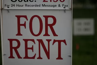
Daniel Hertz of City Commentary has a warning for journalists using stats about average or median rents in a city—be aware that the information used to compile such statistics may be lacking significant amounts of data. Hertz writes that the numbers can often be skewed due to the absence of listings that never make it to Craigslist or other rental web sites.
For a number of reasons, just taking the average of all the listings you can find is likely to produce extremely skewed results, with numbers much higher than true average home prices. For one, many apartments, especially on the lower end of the market, aren’t necessarily listed in places that are easy to find—or at all. Instead, landlords find tenants with a sign on a fence or streetlight pole, local (and not necessarily English-language) newspapers, or just word of mouth.
Hertz cites the example of a rent report for the city of Chicago compiled by web site Zumper. Zumper's data skews toward the more expensive listings found in just a handful of neighborhoods, while the cheaper rental listings found in other neighborhoods are missing. Why? Hertz believes that the publicly available listings that web sites like Zumper are accessing are those on the higher end of the spectrum: "Zumper takes the median from its listings, without compensating at all for the fact that its listings are disproportionately concentrated in higher-end neighborhoods."
FULL STORY: Journalists should be wary of “median rent” reports

Making Sense of Median Rent Statistics
Amid the ubiquitous, and inconsistent, reportage on rising rents and housing prices, a guide from City Observatory helps point readers toward the most accurate numbers.

Austin Rents Fall for 19th Straight Month
Thanks to a construction boom, the city is no longer the most expensive housing market in Texas.

The Best and Worst Cities for Housing Affordability
The gap between market-rate and affordable rents is much wider in some U.S. cities than others.

Planetizen Federal Action Tracker
A weekly monitor of how Trump’s orders and actions are impacting planners and planning in America.

Map: Where Senate Republicans Want to Sell Your Public Lands
For public land advocates, the Senate Republicans’ proposal to sell millions of acres of public land in the West is “the biggest fight of their careers.”

Restaurant Patios Were a Pandemic Win — Why Were They so Hard to Keep?
Social distancing requirements and changes in travel patterns prompted cities to pilot new uses for street and sidewalk space. Then it got complicated.

Platform Pilsner: Vancouver Transit Agency Releases... a Beer?
TransLink will receive a portion of every sale of the four-pack.

Toronto Weighs Cheaper Transit, Parking Hikes for Major Events
Special event rates would take effect during large festivals, sports games and concerts to ‘discourage driving, manage congestion and free up space for transit.”

Berlin to Consider Car-Free Zone Larger Than Manhattan
The area bound by the 22-mile Ringbahn would still allow 12 uses of a private automobile per year per person, and several other exemptions.
Urban Design for Planners 1: Software Tools
This six-course series explores essential urban design concepts using open source software and equips planners with the tools they need to participate fully in the urban design process.
Planning for Universal Design
Learn the tools for implementing Universal Design in planning regulations.
Heyer Gruel & Associates PA
JM Goldson LLC
Custer County Colorado
City of Camden Redevelopment Agency
City of Astoria
Transportation Research & Education Center (TREC) at Portland State University
Camden Redevelopment Agency
City of Claremont
Municipality of Princeton (NJ)