


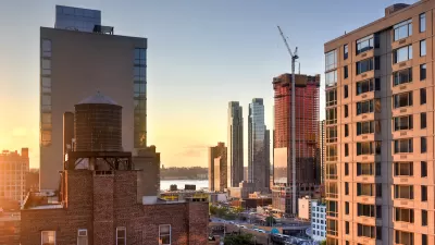
A new online interactive project allows new access to the history of Manhattan before Dutch settlers began taking residence on the island in 1609
"The Wildlife Conservation Society’s Welikia Project (named after the Lenape term for “my good home”) is an ambitious, interactive re-creation of what Manhattan was like in 1609, when the Dutch began settling the island," according to a post by John Metcalfe.
Welikia allows users to roam the island, encountering its original geology and remarkable biodiversity. And an amazing natural environment it was: Welikia claims that the island's "biodiversity per acre rivaled that of national parks like Yellowstone, Yosemite and the Great Smoky Mountains!"
The website functions by allowing users to scroll from "present" to "past." In the past, you can compare, block by block, the characteristics of the island in 1609 to the present day. Included among the descriptions are the presence of the Lenape, also known as Delaware Indians.
So, for instance:
"The shoreline next to the World Trade Center site had a medium likelihood of harboring meadow voles, white-footed mice, ospreys, redback salamanders, black-cherry trees, and a daisylike plant called prairie fleabane. It was dominated by hillsides and, for the Lenape, had less-than-optimal opportunities for hunting but great chances of foraging."
The project has gaps left to fill, however, and donations to the Wildlife Conservation Society will earn "a shout-out in these unexplored zones once they’re completed," reports Metcalfe.
FULL STORY: Explore the Lush, Overgrown Ecology of 1600s Manhattan


Report Reveals Proposed NYC Congestion Pricing Details
The draft proposal indicates most drivers would pay $15 to enter the Central Business District.
Zero New Housing Permits Issued in Manhattan Last Month
July was a dead month when it comes to approving new housing units.
Staten Island Sues Over Congestion Pricing, Too
The borough’s president says the plan would bring more traffic to Staten Island and unjustly burden its residents with air pollution and tolls.

Planetizen Federal Action Tracker
A weekly monitor of how Trump’s orders and actions are impacting planners and planning in America.

San Francisco's School District Spent $105M To Build Affordable Housing for Teachers — And That's Just the Beginning
SFUSD joins a growing list of school districts using their land holdings to address housing affordability challenges faced by their own employees.

Can We Please Give Communities the Design They Deserve?
Often an afterthought, graphic design impacts everything from how we navigate a city to how we feel about it. One designer argues: the people deserve better.

The EV “Charging Divide” Plaguing Rural America
With “the deck stacked” against rural areas, will the great electric American road trip ever be a reality?

Judge Halts Brooklyn Bike Lane Removal
Lawyers must prove the city was not acting “arbitrarily, capriciously, and illegally” in ordering the hasty removal.

Engineers Gave America's Roads an Almost Failing Grade — Why Aren't We Fixing Them?
With over a trillion dollars spent on roads that are still falling apart, advocates propose a new “fix it first” framework.
Urban Design for Planners 1: Software Tools
This six-course series explores essential urban design concepts using open source software and equips planners with the tools they need to participate fully in the urban design process.
Planning for Universal Design
Learn the tools for implementing Universal Design in planning regulations.
Borough of Carlisle
Smith Gee Studio
City of Camden Redevelopment Agency
City of Astoria
Transportation Research & Education Center (TREC) at Portland State University
City of Camden Redevelopment Agency
Municipality of Princeton (NJ)