


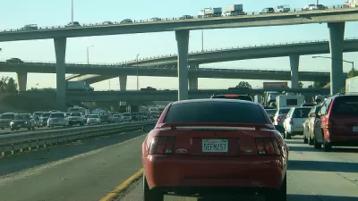
At some point, in places all over the country, freeways stopped working as they were intended. What can be done to improve one of the great frustrations of life with a car?
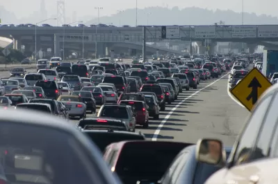
Rick Paulus examines a provocative question at the heart of the contemporary experience: "Highways are created with the purpose of allowing masses to move to distant places in relatively stress-free conditions….There isn't a city in the country that doesn't have some version of a congested stretch like this. So why does a highway go bad? And what can be done to fix it?"
Paulus calls on a series of experts to answer the question. Blair Barnhardt, an expert in pavement management and author of the Book on Better Roads, notes how long it takes to build roads and a particularly scary consequence of that delivery timeline: "By the time of its design, it's already out of date."
The article examines the research of Matthew Turner of the University of Toronto and Gilles Duranton from the University of Pennsylvania who found evidence of induced demand. Or, as Sean Nozzari, deputy district director at Caltrans, puts it: "We can no longer build our way out of congestion."
In the end, Paulus argues in favor of technology-driven solutions like traffic management systems and congestion pricing as the solution for those challenges.
FULL STORY: When a Highway Goes Bad

If You Build It, Cars Will Come: the Common-Sense Logic of 'Induced Demand'
Highway expansion has been shown, time and again, to increase traffic and congestion. Cities are finally getting the message.

Research Shows More Roads = More Driving
A national study shows, once again, that increasing road supply induces additional vehicle travel, particularly over the long run.

Why Traffic Never Gets Better
Despite abundant research showing that roadway expansions provide limited congestion relief and increase long-term traffic problems, they still occur due to wishful thinking: advocates claim that “this” project is different.

Planetizen Federal Action Tracker
A weekly monitor of how Trump’s orders and actions are impacting planners and planning in America.

Congressman Proposes Bill to Rename DC Metro “Trump Train”
The Make Autorail Great Again Act would withhold federal funding to the system until the Washington Metropolitan Area Transit Authority (WMATA), rebrands as the Washington Metropolitan Authority for Greater Access (WMAGA).

DARTSpace Platform Streamlines Dallas TOD Application Process
The Dallas transit agency hopes a shorter permitting timeline will boost transit-oriented development around rail stations.

Parks: Essential Community Infrastructure — and a Smart Investment
Even during times of budget constraint, continued investment in parks is critical, as they provide proven benefits to public health, safety, climate resilience, and community well-being — particularly for under-resourced communities.

Porches, Pets, and the People We Grow Old With
Neighborhood connections and animal companions matter to aging with dignity, and how we build can support them. Here’s a human-scale proposal for aging in place.

Single-Stair Design Contest Envisions Human-Scale Buildings
Single-stair building construction is having a resurgence in the United States, where, for the last several decades, zoning codes have required more than one staircase in multi-story housing developments.
Urban Design for Planners 1: Software Tools
This six-course series explores essential urban design concepts using open source software and equips planners with the tools they need to participate fully in the urban design process.
Planning for Universal Design
Learn the tools for implementing Universal Design in planning regulations.
City of Charlotte
Municipality of Princeton
City of Camden Redevelopment Agency
City of Astoria
Transportation Research & Education Center (TREC) at Portland State University
US High Speed Rail Association
City of Camden Redevelopment Agency
Municipality of Princeton (NJ)