


Not all streets are created equal: Some have sidewalks and some don't.
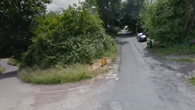
Stephen Fesler shares a map of Seattle streets that lack sidewalks—a hot button issue in Seattle where residents of some neighborhoods are "infuriated that they still don't have access to walking facilities in their neighborhoods."
The map reveals that streets north of 85th Street as well as streets in the Industrial District, West Seattle, and Southeast Seattle are lacking sidewalks.
"For a bit of perspective though, it's worth noting that Seattle has over 2,000 miles of sidewalks, which collectively cover 72% of city blocks. The City of Seattle estimates that replacement cost of this existing infrastructure is somewhere around $1.5 billion. But that still leaves some 900 miles (28% of city blocks) without any sidewalks; adding those to the pedestrian network would cost at least another $675 million."
The post goes on to explain how some of the neighborhoods without sidewalks got that way (hint: late incorporation) as well as how excuses and promises are sometimes what residents get instead of action regarding the state of pedestrian infrastructure in their neighborhoods.
FULL STORY: MAP OF THE WEEK: LACK OF SIDEWALKS IN SEATTLE

Proposal Could Mandate Sidewalks as Part of Seattle Complete Streets
Almost a third of the city’s neighborhood streets lack sidewalks.
Without Sidewalks, Making Seattle Streets More Pedestrian Friendly
Over a quarter of city blocks lack sidewalk infrastructure. An advocacy project to reduce traffic speeds and increase pedestrian safety on these streets has evolved into a city-funded program.

Seattle's New Updated Pedestrian Master Plan Includes $22 Million for Sidewalks
The promised update for the city of Seattle's Pedestrian Master Plan was released to the public last week.

Planetizen Federal Action Tracker
A weekly monitor of how Trump’s orders and actions are impacting planners and planning in America.

Maui's Vacation Rental Debate Turns Ugly
Verbal attacks, misinformation campaigns and fistfights plague a high-stakes debate to convert thousands of vacation rentals into long-term housing.

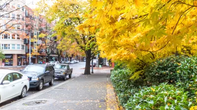
Restaurant Patios Were a Pandemic Win — Why Were They so Hard to Keep?
Social distancing requirements and changes in travel patterns prompted cities to pilot new uses for street and sidewalk space. Then it got complicated.

Charlottesville Temporarily Has No Zoning Code
A judge ordered the Virginia city to throw out its newly revised zoning code, leaving permitting for new development in legal limbo.

In California Battle of Housing vs. Environment, Housing Just Won
A new state law significantly limits the power of CEQA, an environmental review law that served as a powerful tool for blocking new development.

Boulder Eliminates Parking Minimums Citywide
Officials estimate the cost of building a single underground parking space at up to $100,000.
Urban Design for Planners 1: Software Tools
This six-course series explores essential urban design concepts using open source software and equips planners with the tools they need to participate fully in the urban design process.
Planning for Universal Design
Learn the tools for implementing Universal Design in planning regulations.
Heyer Gruel & Associates PA
JM Goldson LLC
Custer County Colorado
City of Camden Redevelopment Agency
City of Astoria
Transportation Research & Education Center (TREC) at Portland State University
Jefferson Parish Government
Camden Redevelopment Agency
City of Claremont