


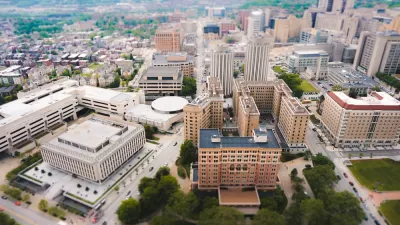
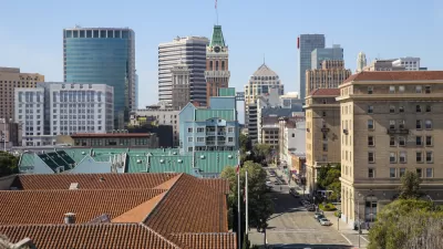
Oakland, as the urban counterpart to San Francisco in the Bay Area, is on a lot of people's radar as a place to improve on some of the lessons of recent waves of urbanization. What planning precedents shaped the city on the other side of the Bay?
Egon Terplan and Magda Maaouidive into four of the seminal plans that created the city of Oakland, California as we know it today. Writing for SPUR, which is launching work in the city, Terplan and Maaoui focus on downtown, where the city and its grid were born.
The article examines four plans, as described in the article:
- The Kellersberger survey and grid (1852);
- The Robinson Plan, which emphasized civic infrastructure but was not implemented (1906);
- The Hegemann Report (1915), which resulted in the implementation of much of the Robinson Plan and included a regional vision for connecting to Berkeley; and
- The Bartholomew Plan, which ushered in planning for the automobile (1928)
The article is recommended reading for anyone who enjoys tracing the planning decisions of the distant past to the city of today, especially in a place as dynamic and fraught as Oakland, California.
If you're interested in following that reading up with an exploration of Oakland's present situation, read this in-depth analysis by Planetizen blogger Reuben Duarte.
FULL STORY: Four Plans That Shaped Downtown Oakland’s First 100 Years

Pittsburgh Moves Ahead With Zoning Changes for University-Adjacent Neighborhood
The implementation of a new master plan for the neighborhood of Oakland, home to the University of Pittsburgh, is moving forward despite controversy and a contentious community engagement process.
Comprehensive Planning Sucks. Here's One Attempt to Make It Better
Thirty community organizations have come together to deliver a response to Oakland's RFP for a comprehensive planning consultant. It's one of three proposals, but certainly the only one with cartoons.
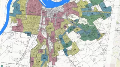
Story Mapping the Racism in Planning History
A Story Map created by the Louisville Metro Office of Planning & Design Services offers a detailed, visual presentation of the history of racism and discriminatory in the planning and zoning of the Louisville and Jefferson County.

Planetizen Federal Action Tracker
A weekly monitor of how Trump’s orders and actions are impacting planners and planning in America.

Map: Where Senate Republicans Want to Sell Your Public Lands
For public land advocates, the Senate Republicans’ proposal to sell millions of acres of public land in the West is “the biggest fight of their careers.”

Restaurant Patios Were a Pandemic Win — Why Were They so Hard to Keep?
Social distancing requirements and changes in travel patterns prompted cities to pilot new uses for street and sidewalk space. Then it got complicated.

Platform Pilsner: Vancouver Transit Agency Releases... a Beer?
TransLink will receive a portion of every sale of the four-pack.

Toronto Weighs Cheaper Transit, Parking Hikes for Major Events
Special event rates would take effect during large festivals, sports games and concerts to ‘discourage driving, manage congestion and free up space for transit.”

Berlin to Consider Car-Free Zone Larger Than Manhattan
The area bound by the 22-mile Ringbahn would still allow 12 uses of a private automobile per year per person, and several other exemptions.
Urban Design for Planners 1: Software Tools
This six-course series explores essential urban design concepts using open source software and equips planners with the tools they need to participate fully in the urban design process.
Planning for Universal Design
Learn the tools for implementing Universal Design in planning regulations.
Heyer Gruel & Associates PA
JM Goldson LLC
Custer County Colorado
City of Camden Redevelopment Agency
City of Astoria
Transportation Research & Education Center (TREC) at Portland State University
Camden Redevelopment Agency
City of Claremont
Municipality of Princeton (NJ)