


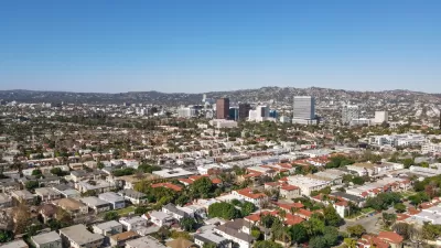
One of the largest ongoing planning efforts in the city of Los Angeles is an update to the Mobility Element of the city's General Plan. A revised version of the draft "Mobility Plan 2035" was released in February.
"This week the Los Angeles Department of City Planning released a revised version of the Mobility Plan 2035 [pdf], an aspirational, wide-ranging blueprint for getting around Los Angeles in the next 20 years," reports the staff at Curbed LA. The Los Angeles Department of City Planning has been working on the update for sevral years, and the current draft incorporates changes following a round of public hearings in March 2014.
According to Curbed LA, "[the major] goals of the plan include establishing a network of 'Complete Streets' that are accessible for both people and cars, reducing greenhouse gas emissions, and solving the ever-vexing 'first-mile/last-mile' issue for getting people to and from all those transit stops already here and on the way."
The post goes on to describe the additional details of the updated version of the plan, including meter pricing, grade crossings, industrial street infrastructure, and bike racks on buses.
FULL STORY: Here's the Big Plan to Make it Way Easier to Get Around Los Angeles Over the Next 20 Years


New Bus Priority Lane Under Construction in Los Angeles
La Brea Avenue will soon gain a new bus priority lane, with plans for more to come still gathering community feedback.

Report: How L.A.'s Transportation System Fails Women
According to an LADOT study, the city's women face disproportionate barriers in accessing safe, efficient transportation.
L.A. Planners Working to Shift Affordable Housing Distribution for More Equitable Results
Almost all the affordable housing development in L.A. in the past decade has occurred in majority-minority neighborhoods. The L.A. Department of City Planning is looking for ways to make sure high-income areas do more of their fair share.

Maui's Vacation Rental Debate Turns Ugly
Verbal attacks, misinformation campaigns and fistfights plague a high-stakes debate to convert thousands of vacation rentals into long-term housing.

Planetizen Federal Action Tracker
A weekly monitor of how Trump’s orders and actions are impacting planners and planning in America.

San Francisco Suspends Traffic Calming Amidst Record Deaths
Citing “a challenging fiscal landscape,” the city will cease the program on the heels of 42 traffic deaths, including 24 pedestrians.

Defunct Pittsburgh Power Plant to Become Residential Tower
A decommissioned steam heat plant will be redeveloped into almost 100 affordable housing units.

Trump Prompts Restructuring of Transportation Research Board in “Unprecedented Overreach”
The TRB has eliminated more than half of its committees including those focused on climate, equity, and cities.

Amtrak Rolls Out New Orleans to Alabama “Mardi Gras” Train
The new service will operate morning and evening departures between Mobile and New Orleans.
Urban Design for Planners 1: Software Tools
This six-course series explores essential urban design concepts using open source software and equips planners with the tools they need to participate fully in the urban design process.
Planning for Universal Design
Learn the tools for implementing Universal Design in planning regulations.
Heyer Gruel & Associates PA
JM Goldson LLC
Custer County Colorado
City of Camden Redevelopment Agency
City of Astoria
Transportation Research & Education Center (TREC) at Portland State University
Jefferson Parish Government
Camden Redevelopment Agency
City of Claremont