


A newly released report shows the demographic transformation of American cities spatially from 1990 to 2012 by charting their neighborhoods based on distance to the center of the city.

A startling transformation has taken place in American cities over the last 20 years. Central cities around the country are experiencing a resurgence of popularity, especially among young adults, but inner-ring suburbs have become less attractive to middle-class residents. While widely-discussed and anecdotally-supported, this trend has been difficult to define and visualize statistically. A new report from the University of Virginia Demographics Research Group uses an innovative way of analyzing census data to compare how proximity to downtown mattered in 1990 and 2012.
The study by Luke Juday, an analyst with the research group, looked at nine variables in 66 cities, including the 50 largest metropolitan areas in the country. The report uses Charlotte, NC and Houston, TX to explain many of the changes, but includes graphs of other cities around the country as well. An interactive page allows users to see graphs of their own city and compare it with other cities across the country.
The report concludes that:
- Since 1990, downtowns and central neighborhoods in cities across the country have attracted significantly more educated and higher-income residents.
- Young adults (22-34 years old) have increased as a proportion of residents in the center of nearly every city in the country, while falling as a proportion across all other areas.
- Older residents (60 and up) form a smaller proportion of the inner-city population than they did in 1990.
- Most cities have seen a decrease in income and education levels several miles outside the core. How far outside depends on the city, with the sharpest drop being anywhere from 4 to 15 miles from the center.
- Households below the federal poverty line are increasingly migrating outwards from the center of cities. The poverty rate has increased significantly several miles outside the core in many cities.
- Racial groups are less concentrated in particular rings than they once were.
- Most growth in housing units and population continues to come at the outer edges of cities. Residents of the outer ring tend to be more educated and have higher incomes. They are much less likely to be younger adults.
FULL STORY: The Changing Shape of American Cities


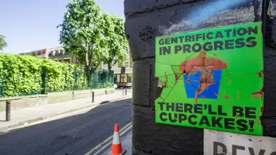
The Gentrification Effect of Urban Parks
New research finds that different types of parks correlate with different gentrification effects, adding to the complexity of urban change.
Review: 'The Handbook of Gentrification Studies'
A book by Loretta Lees and Martin Phillips, published in 2018, is reviewed and recommended to "graduates studying anthropology of cities, urbanism, geography, and new urban identities."

'Climate Gentrification' Is Exacerbating Economic Inequality in Miami
A new study shows that over the last several decades the price of real estate has been heavily influenced by the actual and anticipated effects of climate change.

Planetizen Federal Action Tracker
A weekly monitor of how Trump’s orders and actions are impacting planners and planning in America.

San Francisco's School District Spent $105M To Build Affordable Housing for Teachers — And That's Just the Beginning
SFUSD joins a growing list of school districts using their land holdings to address housing affordability challenges faced by their own employees.

The Tiny, Adorable $7,000 Car Turning Japan Onto EVs
The single seat Mibot charges from a regular plug as quickly as an iPad, and is about half the price of an average EV.

As Trump Phases Out FEMA, Is It Time to Flee the Floodplains?
With less federal funding available for disaster relief efforts, the need to relocate at-risk communities is more urgent than ever.

With Protected Lanes, 460% More People Commute by Bike
For those needing more ammo, more data proving what we already knew is here.

In More Metros Than You’d Think, Suburbs are Now More Expensive Than the City
If you're moving to the burbs to save on square footage, data shows you should think again.
Urban Design for Planners 1: Software Tools
This six-course series explores essential urban design concepts using open source software and equips planners with the tools they need to participate fully in the urban design process.
Planning for Universal Design
Learn the tools for implementing Universal Design in planning regulations.
Smith Gee Studio
City of Charlotte
City of Camden Redevelopment Agency
City of Astoria
Transportation Research & Education Center (TREC) at Portland State University
US High Speed Rail Association
City of Camden Redevelopment Agency
Municipality of Princeton (NJ)