


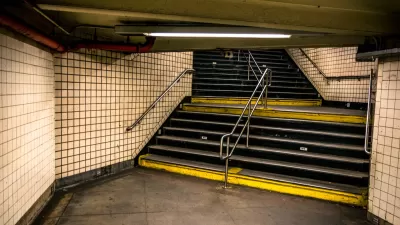
Scott Schafer pens a column inspired by watching a visually impaired woman navigate a busy corner of Minneapolis. The question raised by the column: How can we improve level of service for the blind?
Scott Schafer's recent column for Streets.mn is thoughtful reminder of the many people neglected by engineering to auto-centric level of service standards. After watching a visually impaired women navigate a busy intersection to get to the Vision Loss Resources center, obviously an essential facility for the women's quality of life, once she actually gets inside the door.
Schafer takes a moment to imagine how scared he would be to navigate the street without the benefit of site. Then he starts to imagine solutions:
"What can we do to make it better? The Model Design Manual for Living Streets has at least two suggestions to make sidewalks safe. First, make sidewalks level. By making the ramp steeper and routing the sidewalk slightly away from the street, we can keep the sidewalk from sloping."
Schafer's column ends with a call to shift the myopic considerations of the planners, engineers, and designers shaping the world: "What's Lyndale's level of service for the sight-impaired woman I saw last week?"
FULL STORY: Improving Level of Service for Blind People


Portland's Biketown to Include 'Adaptive Bikes' to Ensure Universal Access
The city of Portland is wearing the Yellow Jersey on equity issues connected to the Biketown bikeshare system.
Urban Living as a Quadriplegic
Peter Apps, a quadriplegic for the past nine years, shares insight into how he evaluates the mobility and access of cities.
Saturday Satire: The Accessibility Meeting Is Located Down Three Flights of Stairs
A satirical piece published by McSweeney's calls attention to the remaining work to done in building a truly accessible built environment.

Planetizen Federal Action Tracker
A weekly monitor of how Trump’s orders and actions are impacting planners and planning in America.

Maui's Vacation Rental Debate Turns Ugly
Verbal attacks, misinformation campaigns and fistfights plague a high-stakes debate to convert thousands of vacation rentals into long-term housing.

Restaurant Patios Were a Pandemic Win — Why Were They so Hard to Keep?
Social distancing requirements and changes in travel patterns prompted cities to pilot new uses for street and sidewalk space. Then it got complicated.

In California Battle of Housing vs. Environment, Housing Just Won
A new state law significantly limits the power of CEQA, an environmental review law that served as a powerful tool for blocking new development.

Boulder Eliminates Parking Minimums Citywide
Officials estimate the cost of building a single underground parking space at up to $100,000.

Orange County, Florida Adopts Largest US “Sprawl Repair” Code
The ‘Orange Code’ seeks to rectify decades of sprawl-inducing, car-oriented development.
Urban Design for Planners 1: Software Tools
This six-course series explores essential urban design concepts using open source software and equips planners with the tools they need to participate fully in the urban design process.
Planning for Universal Design
Learn the tools for implementing Universal Design in planning regulations.
Heyer Gruel & Associates PA
JM Goldson LLC
Custer County Colorado
City of Camden Redevelopment Agency
City of Astoria
Transportation Research & Education Center (TREC) at Portland State University
Jefferson Parish Government
Camden Redevelopment Agency
City of Claremont