


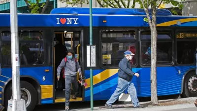
The Regional Plan Association released a report this week finding New York's transit system to be irrationally skewed toward Manhattan service. The report proposes a list of capital projects to correct the imbalance.
"The outer boroughs have more residents commuting within them than to Manhattan. But you wouldn't know it from looking at a map of New York City's transit network," according to a post by the Regional Plan Association.
That information is one of the findings of a report released this week by RPA titled "Overlooked Boroughs." Here's more on the counterintuitive balance of commuters in the outer boroughs as compared to Manhattan:
"New York's transit network was designed in the early part of the last century to bring residents to the urban core and out again. Yet more people commute within the outer boroughs than from Queens, Brooklyn, Staten Island or the Bronx to Manhattan. Roughly 1.7 million residents of the four outer boroughs commuted to jobs within those boroughs in 2010, an increase of 18% from a decade earlier. Fewer New Yorkers - about one million -- commuted to jobs from the outer boroughs to Manhattan, up 12% from 2010."
The report includes a number of transportation planning recommendations to address the future (and present) needs of the New York metropolitan transportation system. A few examples:
- "Increase the frequency of bus service on dozens of outer-borough route"
- "Run a 24-mile overground rail line running on an existing rail right-of-way from Bay Ridge in Brooklyn, through Queens, to Co-Op City in the Bronx, to carry passengers directly from one outer borough to another"
- "Extend the Second Avenue subway both north to the Bronx and south to Lower Manhattan"
There is a lot more in both the executive summary [pdf] and the full technical report [pdf].
FULL STORY: Manhattan-Centric Transit System Falls Short in Other Boroughs


Changes to Local Service in the Bronx Benefit Bus Speeds, Ridership
Another example of how improving bus service design can benefit transit riders and transit systems emerges in New York City. More such local system redesigns are on the way soon in the Big Apple.
All-Door Boarding Stuck in Neutral in New York City
MTA leadership has decided all-door boarding will lead to fare evasion and isn’t willing to adopt a program that was already well underway.
New York Post-Pandemic First: Big Transit Service Changes
More service on the weekends, less on Monday and Friday, reflects the patterns of post-pandemic transit ridership.

Planetizen Federal Action Tracker
A weekly monitor of how Trump’s orders and actions are impacting planners and planning in America.

Restaurant Patios Were a Pandemic Win — Why Were They so Hard to Keep?
Social distancing requirements and changes in travel patterns prompted cities to pilot new uses for street and sidewalk space. Then it got complicated.

Map: Where Senate Republicans Want to Sell Your Public Lands
For public land advocates, the Senate Republicans’ proposal to sell millions of acres of public land in the West is “the biggest fight of their careers.”

Orange County, Florida Adopts Largest US “Sprawl Repair” Code
The ‘Orange Code’ seeks to rectify decades of sprawl-inducing, car-oriented development.

Maui's Vacation Rental Debate Turns Ugly
Verbal attacks, misinformation campaigns and fistfights plague a high-stakes debate to convert thousands of vacation rentals into long-term housing.

San Francisco Suspends Traffic Calming Amidst Record Deaths
Citing “a challenging fiscal landscape,” the city will cease the program on the heels of 42 traffic deaths, including 24 pedestrians.
Urban Design for Planners 1: Software Tools
This six-course series explores essential urban design concepts using open source software and equips planners with the tools they need to participate fully in the urban design process.
Planning for Universal Design
Learn the tools for implementing Universal Design in planning regulations.
Heyer Gruel & Associates PA
JM Goldson LLC
Custer County Colorado
City of Camden Redevelopment Agency
City of Astoria
Transportation Research & Education Center (TREC) at Portland State University
Camden Redevelopment Agency
City of Claremont
Municipality of Princeton (NJ)