


The New Yorker has published an interactive feature in New York's shadow transit system—the network of so-called "dollar vans."
Aaron Reiss writes the article that accompanies an interactive feature about New York's "dollar vans, beginning with a brief history of their invention and proliferation, dating back to a transit strike in 1980.
"Today, dollar vans and other unofficial shuttles make up a thriving shadow transportation system that operates where subways and buses don’t—mostly in peripheral, low-income neighborhoods that contain large immigrant communities and lack robust public transit. The informal transportation networks fill that void with frequent departures and dependable schedules, but they lack service maps, posted timetables, and official stations or stops. There is no Web site or kiosk to help you navigate them. Instead, riders come to know these networks through conversations with friends and neighbors, or from happening upon the vans in the street."
The article consists of a series of interactive vignettes, focusing on each of the many "dollar van" lines—from a network connecting the various Chinatown communities around the city, to the Caribbean communities that power the network in Flatbush, and more. There are even several "dollar van" routes that cross the Hudson River into New Jersey via the George Washington Bridge and the Lincoln Tunnel.
[Editor's note: this article made the rounds this week on the social media discussion. It isn’t as current as submissions to the Planetizen news feed, but it was too compelling to pass up an opportunity to share. Enjoy.]
FULL STORY: New York's Shadow Transit

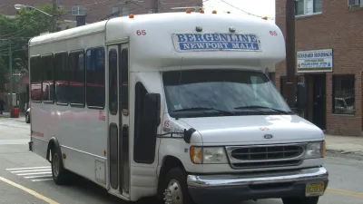
What is the Future of NYC’s ‘Dollar Vans’?
A semi-formal transportation system has served New Yorkers for half a century, but complex regulations prevent most drivers from operating legally.
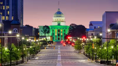
Proposed Alabama Bill Would Fund Public Transit
The senator who introduced the legislation cited concerns about the state’s low levels of workforce participation, noting that a lack of transportation is one of the main reasons Alabama residents can’t participate in the workforce.
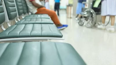
Linking Transportation Access and Public Health
Millions of Americans miss medical care and other important day-to-day appointments due to a lack of access to reliable transportation.

Planetizen Federal Action Tracker
A weekly monitor of how Trump’s orders and actions are impacting planners and planning in America.

Congressman Proposes Bill to Rename DC Metro “Trump Train”
The Make Autorail Great Again Act would withhold federal funding to the system until the Washington Metropolitan Area Transit Authority (WMATA), rebrands as the Washington Metropolitan Authority for Greater Access (WMAGA).

The Simple Legislative Tool Transforming Vacant Downtowns
In California, Michigan and Georgia, an easy win is bringing dollars — and delight — back to city centers.

The States Losing Rural Delivery Rooms at an Alarming Pace
In some states, as few as 9% of rural hospitals still deliver babies. As a result, rising pre-term births, no adequate pre-term care and "harrowing" close calls are a growing reality.

The Small South Asian Republic Going all in on EVs
Thanks to one simple policy change less than five years ago, 65% of new cars in this Himalayan country are now electric.

DC Backpedals on Bike Lane Protection, Swaps Barriers for Paint
Citing aesthetic concerns, the city is removing the concrete barriers and flexposts that once separated Arizona Avenue cyclists from motor vehicles.
Urban Design for Planners 1: Software Tools
This six-course series explores essential urban design concepts using open source software and equips planners with the tools they need to participate fully in the urban design process.
Planning for Universal Design
Learn the tools for implementing Universal Design in planning regulations.
Smith Gee Studio
City of Charlotte
City of Camden Redevelopment Agency
City of Astoria
Transportation Research & Education Center (TREC) at Portland State University
US High Speed Rail Association
City of Camden Redevelopment Agency
Municipality of Princeton (NJ)