


California has commenced new water use reporting requirements, which the Pacific Institute has compiled into an interactive map and database to provide accessible evidence about where the state's water goes.
"A new web app from the Pacific Institute shows how different California cities are responding to the ongoing drought. This web feature brings to life newly-released data on urban water use, and allows users to explore trends and patterns in that use," according to a post on the Pacific Institute's website.
The database is made possible by requirements dating back to July 2014 requiring urban water utilities with more than 3,000 customers to report water use each month. "These new data show total urban water use, as well as residential water use, i.e., the estimated portion used by residents in and around their homes."
As explained by the Pacific Institute, the database and map allows users to pose and answer questions about urban water use. "For example, why is water use higher or lower in some areas? How have cities responded to Governor Jerry Brown’s call to reduce their water use by 20 percent? Have high water users had more success at conservation than areas where water use was already low?"
FULL STORY: Interactive Map of California’s Urban Water Use


Californians Struggle To Cut Water Use
The state is slowly starting to curb water consumption, but progress has been ‘disappointingly slow’ as water supplies across the West diminish to historic lows.

Using Artificial Intelligence to Map Telecommuting Prevalence
In the Philadelphia region, residents of wealthier neighborhoods will be more likely to work from home in the future, thus altering travel patterns and transit usage, according to a new mapping project powered by artificial intelligence (AI).
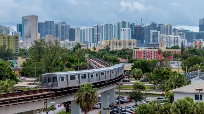
New Tool Puts Miami Development Opportunities on the Map
There's plenty of vacant or underutilized land to be found in Miami-Dade County, if you know where and how to look.

Maui's Vacation Rental Debate Turns Ugly
Verbal attacks, misinformation campaigns and fistfights plague a high-stakes debate to convert thousands of vacation rentals into long-term housing.

Planetizen Federal Action Tracker
A weekly monitor of how Trump’s orders and actions are impacting planners and planning in America.

In Urban Planning, AI Prompting Could be the New Design Thinking
Creativity has long been key to great urban design. What if we see AI as our new creative partner?

Massachusetts Budget Helps Close MBTA Budget Gap
The budget signed by Gov. Maura Healey includes $470 million in MBTA funding for the next fiscal year.

Milwaukee Launches Vision Zero Plan
Seven years after the city signed its Complete Streets Policy, the city is doubling down on its efforts to eliminate traffic deaths.

Portland Raises Parking Fees to Pay for Street Maintenance
The city is struggling to bridge a massive budget gap at the Bureau of Transportation, which largely depleted its reserves during the Civd-19 pandemic.
Urban Design for Planners 1: Software Tools
This six-course series explores essential urban design concepts using open source software and equips planners with the tools they need to participate fully in the urban design process.
Planning for Universal Design
Learn the tools for implementing Universal Design in planning regulations.
Gallatin County Department of Planning & Community Development
Heyer Gruel & Associates PA
JM Goldson LLC
City of Camden Redevelopment Agency
City of Astoria
Transportation Research & Education Center (TREC) at Portland State University
Jefferson Parish Government
Camden Redevelopment Agency
City of Claremont