


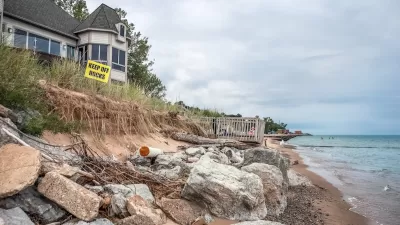
Climate change and rising seas will mean higher flood risks for cities. But when exactly will impactful flooding become a regular occurrence? New analysis by the Union of Concerned Scientists says that time is fast approaching.
Planners working on resilience against flooding take heed. A report, released this month by the Union of Concerned Scientists, says tidal flooding may soon affect urban areas, especially on the Atlantic and Gulf coasts. Forecasts of hurricane and storm risks are plentiful in the wake of Sandy and Katrina, but research into higher tides is harder to come by.
Melanie Fitzpatrick, one of the researchers who compiled the report, remarked, “The shock for us was that tidal flooding could become the new normal in the next 15 years; we didn’t think it would be so soon.”
The team used sea-level data from the recent National Climate Assessment and from Climate Central to determine that “in the absence of flood-deflecting marshes, seawalls or levees, two-thirds of the 52 communities studied can expect a tripling in the frequency of high-tide flooding during the next 15 years.”
The researchers conclude that tidal “nuisance flooding,” though not as dramatic as a major storm, is a real and apparent resilience challenge. They advocate communication between affected cities to coordinate best responses. The article includes an interactive map that displays the report’s flooding predictions for U.S. cities based on a number of parameters.
FULL STORY: Sea Level Rise Making Floods Routine for Coastal Cities

How US Cities Can Prepare for Climate Disasters
Resilience, encompassing infrastructure, governance, economic strength, and social cohesion, is critical for cities to mitigate rising climate risks like flooding, wildfires, and heat, ensuring long-term recovery and adaptability.
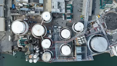
Climate Change Putting Coastal Infrastructure at Risk
More than 1,000 coastal facilities could flood as often as once a month as sea levels rise, according to a study from the Union of Concerned Scientists.
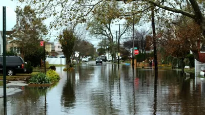
New York Updating its Flood Resilience Zoning
New York City intends to make sure that zoning codes are a tool for preventing the risks of flooding.

Maui's Vacation Rental Debate Turns Ugly
Verbal attacks, misinformation campaigns and fistfights plague a high-stakes debate to convert thousands of vacation rentals into long-term housing.

Planetizen Federal Action Tracker
A weekly monitor of how Trump’s orders and actions are impacting planners and planning in America.

San Francisco Suspends Traffic Calming Amidst Record Deaths
Citing “a challenging fiscal landscape,” the city will cease the program on the heels of 42 traffic deaths, including 24 pedestrians.

Defunct Pittsburgh Power Plant to Become Residential Tower
A decommissioned steam heat plant will be redeveloped into almost 100 affordable housing units.

Trump Prompts Restructuring of Transportation Research Board in “Unprecedented Overreach”
The TRB has eliminated more than half of its committees including those focused on climate, equity, and cities.

Amtrak Rolls Out New Orleans to Alabama “Mardi Gras” Train
The new service will operate morning and evening departures between Mobile and New Orleans.
Urban Design for Planners 1: Software Tools
This six-course series explores essential urban design concepts using open source software and equips planners with the tools they need to participate fully in the urban design process.
Planning for Universal Design
Learn the tools for implementing Universal Design in planning regulations.
Heyer Gruel & Associates PA
JM Goldson LLC
Custer County Colorado
City of Camden Redevelopment Agency
City of Astoria
Transportation Research & Education Center (TREC) at Portland State University
Jefferson Parish Government
Camden Redevelopment Agency
City of Claremont