


An ongoing planning effort in Oklahoma City would revitalize a neighborhood adjacent to the city's downtown core long neglected by bad planning.
Dustin Akers tipped off Angie Schmitt at Streetsblog about the goings on in Oklahoma City's "Core to Shore" area. A comparison of aerial photos, one from 1932 and one from 2014, make the point about the city's radical transformation over the past 80 years. So what happened? "The answer, according to Akers, boils down to a few things: An elevated highway, misguided urban renewal policies, flight and disinvestment," writes Schmitt.
Enter the city's Core to Shore plan, which, according to the city's website, calls for the following:
- Creation of a world-class, pedestrian-friendly boulevard
- Development of a 40-acre central park
- Development of business, retail and mixed use housing along the central park
- Building of a Convention Center and Convention Center hotel
- Relocation of some of the existing businesses and homes in the area
The plan dates back to 2006 (and adopted in 2008 [pdf]), but the city's website includes updates, including a market study from 2007 [pdf] and a study by the Urban Land Institute [pdf] from 2010.
FULL STORY: Before/After: The 80-Year Leveling of an Oklahoma City Neighborhood


BikeWalkOKC Plan Updated After Five Years of Progress
The BikeWalkOKC plan has proceeded faster than expected after its approval in 2018. A 2023 update is expected to pick up where the 2018 plan left off.
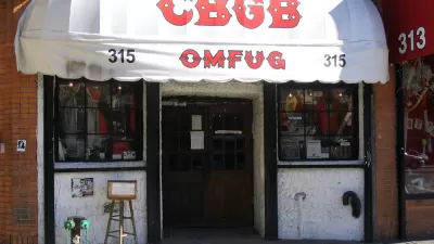
Opinion: Lower Rents Will Give Downtown Spaces Back to the ‘Weirdos’
Introducing the “CBGB theory of city planning.”
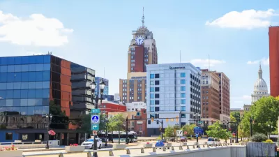
East Lansing Parking Plan Aims for Walkability
East Lansing wants to ditch some of its surface parking to encourage economic activity and walkability.

Planetizen Federal Action Tracker
A weekly monitor of how Trump’s orders and actions are impacting planners and planning in America.

Map: Where Senate Republicans Want to Sell Your Public Lands
For public land advocates, the Senate Republicans’ proposal to sell millions of acres of public land in the West is “the biggest fight of their careers.”

Restaurant Patios Were a Pandemic Win — Why Were They so Hard to Keep?
Social distancing requirements and changes in travel patterns prompted cities to pilot new uses for street and sidewalk space. Then it got complicated.

Platform Pilsner: Vancouver Transit Agency Releases... a Beer?
TransLink will receive a portion of every sale of the four-pack.

Toronto Weighs Cheaper Transit, Parking Hikes for Major Events
Special event rates would take effect during large festivals, sports games and concerts to ‘discourage driving, manage congestion and free up space for transit.”

Berlin to Consider Car-Free Zone Larger Than Manhattan
The area bound by the 22-mile Ringbahn would still allow 12 uses of a private automobile per year per person, and several other exemptions.
Urban Design for Planners 1: Software Tools
This six-course series explores essential urban design concepts using open source software and equips planners with the tools they need to participate fully in the urban design process.
Planning for Universal Design
Learn the tools for implementing Universal Design in planning regulations.
Heyer Gruel & Associates PA
JM Goldson LLC
Custer County Colorado
City of Camden Redevelopment Agency
City of Astoria
Transportation Research & Education Center (TREC) at Portland State University
Camden Redevelopment Agency
City of Claremont
Municipality of Princeton (NJ)