


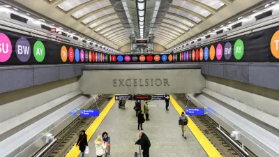
The Center for Transportation Studies at the University of Minnesota has released the Access Across America: Transit 2014 report.
David Levinson shares news of a new report (authored Levinson and Andrew Owen) that "examines accessibility to jobs by transit in 46 of the 50 largest (by population) metropolitan areas in the United States." The report, "Access Across America: Transit 2014," follows up on the work of "Access Across America: Auto 2013." The report includes interactive maps.
Levinson explains the methodology of the report: "Rankings are determined by a weighted average of accessibility, giving a higher weight to closer jobs. Jobs reachable within ten minutes are weighted most heavily, and jobs are given decreasing weight as travel time increases up to 60 minutes."
Emily Badger also shared insights into the report on the Washington Post's Wonkblog, including this insight on the potential of these maps to influence land use and transportation choices: "From a transit perspective, these maps can also illustrate how small changes in service — a few more buses at rush hour, more frequent connections in the subway — could dramatically alter access to jobs across town."
FULL STORY: ACCESS ACROSS AMERICA: TRANSIT 2014 … #ACCESSJOBSTRANSIT

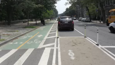
Bike Infrastructure and Economic Opportunity
A study from the University of Minnesota documents how bike infrastructure can connect workers to jobs, maps job accessibility and ranks U.S. cities by bike access to jobs.
Study Quantifies Job Access in U.S. Cities
An annual survey by the Accessibility Observatory at the University of Minnesota measures job availability, job location, population density, and the availability of transit.

Well Planned Bus Routes Can Help Improve Poverty
A new study by Rahul Pathaka, Christopher K. Wyczalkowskib, Xi Huangb produces new evidence for the most effective method for improving conditions of poverty.

Planetizen Federal Action Tracker
A weekly monitor of how Trump’s orders and actions are impacting planners and planning in America.

Restaurant Patios Were a Pandemic Win — Why Were They so Hard to Keep?
Social distancing requirements and changes in travel patterns prompted cities to pilot new uses for street and sidewalk space. Then it got complicated.

Map: Where Senate Republicans Want to Sell Your Public Lands
For public land advocates, the Senate Republicans’ proposal to sell millions of acres of public land in the West is “the biggest fight of their careers.”

Maui's Vacation Rental Debate Turns Ugly
Verbal attacks, misinformation campaigns and fistfights plague a high-stakes debate to convert thousands of vacation rentals into long-term housing.

San Francisco Suspends Traffic Calming Amidst Record Deaths
Citing “a challenging fiscal landscape,” the city will cease the program on the heels of 42 traffic deaths, including 24 pedestrians.

California Homeless Arrests, Citations Spike After Ruling
An investigation reveals that anti-homeless actions increased up to 500% after Grants Pass v. Johnson — even in cities claiming no policy change.
Urban Design for Planners 1: Software Tools
This six-course series explores essential urban design concepts using open source software and equips planners with the tools they need to participate fully in the urban design process.
Planning for Universal Design
Learn the tools for implementing Universal Design in planning regulations.
Heyer Gruel & Associates PA
JM Goldson LLC
Custer County Colorado
City of Camden Redevelopment Agency
City of Astoria
Transportation Research & Education Center (TREC) at Portland State University
Camden Redevelopment Agency
City of Claremont
Municipality of Princeton (NJ)