


Are smartphones supplementing the capacity of humans to think spatially, such that future generations might lose fundamental cognitive abilities?
"The rise in mobile navigation technology has, in just a few years, transformed the way we get around cities," writes Henry Gabar. "In 2011, 35 percent of Americans had smartphones; by 2013, that had grown to 61 percent." Moreover, "[three]-quarters of those people now use their phones for directions and location-based services. One in five Americans used the Google Maps app in June; one in eight used Apple Maps. Tens of millions more rely on car-based modules hitched to the satellites of the Global Positioning System."
The question pondered by Gabar is whether humans stand to lose very valuable brainpower in letting their phones take over so much navigation work. "Experts who study the issue are concerned that spatial thinking might be the next casualty of technological progress, another cognitive ability surpassed and then supplanted by the cerebral annex of the Internet….They worry we may become, as a society, what the Japanese call hōkō onchi—deaf to direction."
The longish-read article includes comparisons to the advancements in 19th century cartography that inspired similar fears at the time, as well as the counter argument that the rich data and context-filling capabilities of contemporary maps could actually increase spatial consciousness.
FULL STORY: Smartphones and the Uncertain Future of 'Spatial Thinking'


New Google Map Layer Shows COVID-19 Infection Rates
A new layer showing the seven-day average of confirmed COVID-19 cases started rolling out to Android and iPhones last week.
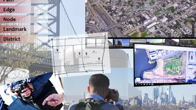
Analyzing Lynch's City Imageability in the Digital Age
Mahbubur Meenar of Rowan University writes about a recent article he co-authored in the Journal of Planning Education and Research
Google Maps Update Opens New Access to Mobility and Culture
Google Maps and other navigation and mapping apps have done a lot to inspire and educate people to make the most of their surroundings. New changes to the Google Maps app will add new functionality for those purposes.

Planetizen Federal Action Tracker
A weekly monitor of how Trump’s orders and actions are impacting planners and planning in America.

Map: Where Senate Republicans Want to Sell Your Public Lands
For public land advocates, the Senate Republicans’ proposal to sell millions of acres of public land in the West is “the biggest fight of their careers.”

Restaurant Patios Were a Pandemic Win — Why Were They so Hard to Keep?
Social distancing requirements and changes in travel patterns prompted cities to pilot new uses for street and sidewalk space. Then it got complicated.

Platform Pilsner: Vancouver Transit Agency Releases... a Beer?
TransLink will receive a portion of every sale of the four-pack.

Toronto Weighs Cheaper Transit, Parking Hikes for Major Events
Special event rates would take effect during large festivals, sports games and concerts to ‘discourage driving, manage congestion and free up space for transit.”

Berlin to Consider Car-Free Zone Larger Than Manhattan
The area bound by the 22-mile Ringbahn would still allow 12 uses of a private automobile per year per person, and several other exemptions.
Urban Design for Planners 1: Software Tools
This six-course series explores essential urban design concepts using open source software and equips planners with the tools they need to participate fully in the urban design process.
Planning for Universal Design
Learn the tools for implementing Universal Design in planning regulations.
Heyer Gruel & Associates PA
JM Goldson LLC
Custer County Colorado
City of Camden Redevelopment Agency
City of Astoria
Transportation Research & Education Center (TREC) at Portland State University
Camden Redevelopment Agency
City of Claremont
Municipality of Princeton (NJ)