


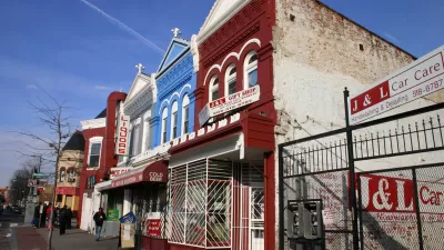
By assessing three different groups of indicators, researchers were able to tour thousands of blocks in Chicago through Google Street View and compare visual signs of reinvestment and renewal between 2007 and 2009.
As reported by Alissa Walker at Gizmodo, a new study by Jackelyn Hwang and Robert J. Sampson published in the American Sociology Review followed the movement of middle and upper-middle-class residents within Chicago's various neighborhoods. However, instead of looking at migratory patterns via Census records, Hwang and Sampson were able to, "isolate three different groups of indicators found on Google Street View images—structural mix, beautification, and lack of disorder and decay—to rank each block" for reinvestment and renewal.
Besides ranking assessed from indicators based on the properties, the study also factors in other forms of investment or disinvestment. For example, "speed bumps and bike lanes are proof of public investment and therefore boosted the block's rating. The presence of trash and graffiti... resulted in a lower score."
Some of the results found when cross-referencing the study's predictors with actual city data help to quantify the spread of gentrification. As Walker notes,
"while [Hwang and Sampson] could clearly see which blocks had showed early signs of gentrification, the process was only likely to continue if at least 35 percent of the residents were white. Even if some gentrification signs were present in neighborhoods that were 40 percent or more black, the process slowed down or eventually stopped."
FULL STORY: Even Scientists Are Using Google Street View to Measure Gentrification


Houston's East River Redevelopment Threatens Historic Black Neighborhoods
Longtime residents are being left behind by new development that has raised housing costs and property taxes for some of Houston's most vulnerable communities, according to an article in the Houston Chronicle.

A Tour of Houston's Rapidly Gentrifying Neighborhoods
These Houston communities have experienced the most dramatic demographic changes in the last decade, according to new Census data.
Is Anti-Growth the Wrong Approach to Fighting Gentrification?
Limiting development has been a powerful tool for anti-gentrification activists, but have these policies had counter-productive effects?

Planetizen Federal Action Tracker
A weekly monitor of how Trump’s orders and actions are impacting planners and planning in America.

Maui's Vacation Rental Debate Turns Ugly
Verbal attacks, misinformation campaigns and fistfights plague a high-stakes debate to convert thousands of vacation rentals into long-term housing.

San Francisco Suspends Traffic Calming Amidst Record Deaths
Citing “a challenging fiscal landscape,” the city will cease the program on the heels of 42 traffic deaths, including 24 pedestrians.

Amtrak Rolls Out New Orleans to Alabama “Mardi Gras” Train
The new service will operate morning and evening departures between Mobile and New Orleans.

The Subversive Car-Free Guide to Trump's Great American Road Trip
Car-free ways to access Chicagoland’s best tourist attractions.

San Antonio and Austin are Fusing Into one Massive Megaregion
The region spanning the two central Texas cities is growing fast, posing challenges for local infrastructure and water supplies.
Urban Design for Planners 1: Software Tools
This six-course series explores essential urban design concepts using open source software and equips planners with the tools they need to participate fully in the urban design process.
Planning for Universal Design
Learn the tools for implementing Universal Design in planning regulations.
Heyer Gruel & Associates PA
JM Goldson LLC
Custer County Colorado
City of Camden Redevelopment Agency
City of Astoria
Transportation Research & Education Center (TREC) at Portland State University
Jefferson Parish Government
Camden Redevelopment Agency
City of Claremont