


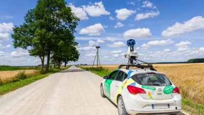
Google Street View
How Digital Mapping Can Reinforce Inequity
Digital mapping tools like Google Street View often obscure the realities of cities and concentrate their resources in the wealthiest countries, effectively ‘erasing’ some places from the global map.

Big Data Brings Bespoke Cities
This start-up uses an AI to comb through Google Street View images, matching users with cities that fit their "lifestyle preferences."

Friday Funny: Sheep View Goes Where Google Street View Can't
Some local residents of the Faroe Islands created Sheep View 360 to document the 18 rocky islands that make up their home—and now Google is lending a hand.
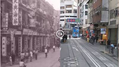
Historic Hong Kong: Visualizing a Changed City
Created with input from historian Mark Footer, this tool overlays street views of modern Hong Kong with historical photos from the colonial era through the 20th century.
Friday Eye Candy: First-Ever Vertical Street View Scales El Capitan in Yosemite
Google Street View climbed 3,000 feet, straight up, to capture the images for its first-ever vertical street view.
How Google Maps Gets the 'Ground Truth' for Street View
A peak under the hood at "Ground Truth"—the operation behind Google Street View.
Study uses Google Street View to Assess Gentrification
By assessing three different groups of indicators, researchers were able to tour thousands of blocks in Chicago through Google Street View and compare visual signs of reinvestment and renewal between 2007 and 2009.
Travel Back in Time with Google Street View
Clear your schedule: a new feature on Google Street View allows users to click through images from the past.
Friday Eye Candy: Revisiting the Sites of Famous Album Covers
For the music aficionados: a recent article in Guardian Cities dug up the Google Street Views of the exact locations of iconic album covers, laying the album cover over the current condition.
What Makes a Place Feel Safe?
Utilizing an online tool that compares images from Google Street View, researchers have built a better understanding of the 'small, often imperceptible reasons' that make some streets and places feel safer than others.
Google Maps Goes Off-Roading
Sarah Laskow reveals what may be the greatest job in the world at the moment - those lucky Google employees who are helping to map areas of the world only accessible on foot.
New Software Can Distinguish a City's DNA
Jacob Aron reports on the promising new software developed by an international group of researchers that can recognize "what makes Paris look like Paris."
Urban Design for Planners 1: Software Tools
This six-course series explores essential urban design concepts using open source software and equips planners with the tools they need to participate fully in the urban design process.
Planning for Universal Design
Learn the tools for implementing Universal Design in planning regulations.
Heyer Gruel & Associates PA
JM Goldson LLC
Custer County Colorado
City of Camden Redevelopment Agency
City of Astoria
Transportation Research & Education Center (TREC) at Portland State University
Jefferson Parish Government
Camden Redevelopment Agency
City of Claremont


