


After plans to create a transit-oriented, pedestrian-friendly district in the Austin suburb of Leander fizzled due to the recession, the city has cut back minimum height and density requirements in the hopes of attracting more investment.
"After months of discussion and several tense town hall meetings, the Leander City Council voted Thursday evening to shrink the zone requiring high density development around the town’s MetroRail station to a little more than a third of its original size," reports Esther Robards-Forbes.
"The overall size of the 2,300-acre, transit-oriented development district hasn’t changed, but the zone designated for high-density, pedestrian-friendly shopping and housing developments has shrunk from more than 1,300 acres to just 520 acres."
As for the unmet expectations that preceded the city's recent moves, Robards-Forbes reports: "For a decade…much of the land has sat empty...Landowners said that developers and builders, particularly the big box stores that had shown interest, were being scared off by heavy restrictions such as minimum height and density requirements. In the areas closest the station, buildings had to be a minimum of two stories and residential buildings were limited in favor of commercial and retail."
FULL STORY: Leander shrinks high-density zone around MetroRail station


Zoning Changes Would Allow Transit-Oriented Multi-Family Development in Montgomery County
Montgomery County, Maryland wants to put its zoning where its transit is—it's just the latest in a string of transit-oriented land use reforms for the famously suburban county.
Unlocking the Potential of Transit Adjacent Land for Housing Affordability
A case study from the Boston region shows the power of allowing moderate density on transit adjacent residential parcels currently available only to single-family detached homes.
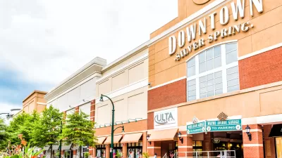
Silver Spring Downtown Plan Expanding to Make Room for the Missing Middle
Planners are hoping that by expanding the boundaries of the Silver Spring Downtown Plan in Montgomery County, Maryland, new opportunities for missing middle housing will create new opportunities for housing affordability.

Planetizen Federal Action Tracker
A weekly monitor of how Trump’s orders and actions are impacting planners and planning in America.

Map: Where Senate Republicans Want to Sell Your Public Lands
For public land advocates, the Senate Republicans’ proposal to sell millions of acres of public land in the West is “the biggest fight of their careers.”

Restaurant Patios Were a Pandemic Win — Why Were They so Hard to Keep?
Social distancing requirements and changes in travel patterns prompted cities to pilot new uses for street and sidewalk space. Then it got complicated.

Platform Pilsner: Vancouver Transit Agency Releases... a Beer?
TransLink will receive a portion of every sale of the four-pack.

Toronto Weighs Cheaper Transit, Parking Hikes for Major Events
Special event rates would take effect during large festivals, sports games and concerts to ‘discourage driving, manage congestion and free up space for transit.”

Berlin to Consider Car-Free Zone Larger Than Manhattan
The area bound by the 22-mile Ringbahn would still allow 12 uses of a private automobile per year per person, and several other exemptions.
Urban Design for Planners 1: Software Tools
This six-course series explores essential urban design concepts using open source software and equips planners with the tools they need to participate fully in the urban design process.
Planning for Universal Design
Learn the tools for implementing Universal Design in planning regulations.
Heyer Gruel & Associates PA
JM Goldson LLC
Custer County Colorado
City of Camden Redevelopment Agency
City of Astoria
Transportation Research & Education Center (TREC) at Portland State University
Camden Redevelopment Agency
City of Claremont
Municipality of Princeton (NJ)