


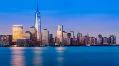
David W. Dunlap recounts how the slurry wall built around the World Trade Center's foundations prevented the devastation to Lower Manhattan from becoming much worse, and "became a symbol of resilience in the months and years after the attack."
After it was built over nine months beginning in 1967 "using jury-rigged tools, on a site that brimmed with uncharted obstacles and unhappy surprises", engineer Arturo Lamberto Ressi di Cervia never thought he'd see the retaining wall he helped construct again in his life. But the events of Sept. 11, 2001 changed that.
"Because the slurry wall held, the 70-foot-deep foundation did not fill with groundwater [when the towers fell]. And because of that, the PATH tubes were not submerged. And because of that, the subway tunnels below the PATH tubes were not inundated," explains Dunlap. "How much worse could Sept. 11 have been? Imagine if Hurricane Sandy had followed the terrorist attack by a few hours."
"Thirty-five years later, in 2002, the architect Daniel Libeskind drew the world’s attention to the symbolic significance of the wall, when he proposed its preservation and exposure as part of the redevelopment of the trade center."
FULL STORY: Looking to a Wall That Limited the World Trade Center’s Devastation

20 Years After 9/11: The 'Age of Skyscrapers' Is Nowhere Near Over
Despite predictions that the events of September 11, 2001 would be the end of skyscrapers, U.S. cities are building more tall buildings than ever.

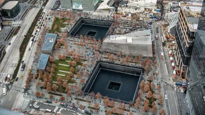
World Trade Center Rebuild Almost Complete With Approval of 900-Foot Mixed-Use Tower
Plans have been approved for the development of 5 World Trade Center, in place of a building damaged on September 11 and eventually torn down.
How 9/11 Inspired Public Service as an Urban Planner
The account of how the terror and tragedy of 9/11 led an urban planner from working for a private consulting firm to working in the public sector.

Planetizen Federal Action Tracker
A weekly monitor of how Trump’s orders and actions are impacting planners and planning in America.

Map: Where Senate Republicans Want to Sell Your Public Lands
For public land advocates, the Senate Republicans’ proposal to sell millions of acres of public land in the West is “the biggest fight of their careers.”

Restaurant Patios Were a Pandemic Win — Why Were They so Hard to Keep?
Social distancing requirements and changes in travel patterns prompted cities to pilot new uses for street and sidewalk space. Then it got complicated.

Platform Pilsner: Vancouver Transit Agency Releases... a Beer?
TransLink will receive a portion of every sale of the four-pack.

Toronto Weighs Cheaper Transit, Parking Hikes for Major Events
Special event rates would take effect during large festivals, sports games and concerts to ‘discourage driving, manage congestion and free up space for transit.”

Berlin to Consider Car-Free Zone Larger Than Manhattan
The area bound by the 22-mile Ringbahn would still allow 12 uses of a private automobile per year per person, and several other exemptions.
Urban Design for Planners 1: Software Tools
This six-course series explores essential urban design concepts using open source software and equips planners with the tools they need to participate fully in the urban design process.
Planning for Universal Design
Learn the tools for implementing Universal Design in planning regulations.
Heyer Gruel & Associates PA
JM Goldson LLC
Custer County Colorado
City of Camden Redevelopment Agency
City of Astoria
Transportation Research & Education Center (TREC) at Portland State University
Camden Redevelopment Agency
City of Claremont
Municipality of Princeton (NJ)