


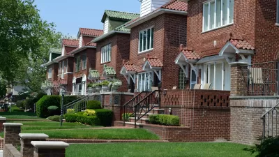
When you think about poverty, do you picture the suburbs? New data suggests that you should.
According to the Brookings Institution, the percentage of suburban residents receiving food stamps increased from 50 to 55 percent between 2007 to 2011. While that change may not sound impressive, Matthew O’Brien writes, it’s startling when put a different way. That is, while total food stamp use during the recession increased by 69 percent in urban areas, total food stamp use in the suburbs went up by a whopping 200 percent.
“The Great Recession accelerated the rise of a new geography of poverty,” O’Brien writes. “Homes that were supposed to . . . lead to the American dream lead to financial ruin instead.”
FULL STORY: Over 50% of Food Stamp Recipients Live in the Suburbs

What Trump Gets Wrong About America’s Suburbs
The Trump administration’s talk about protecting the suburbs is based on misrepresentations of who really lives in suburbs and what these communities need.
The Suburbs, Reimagined
Eight experts produce a "manifesto for a new suburbia."

Looking for the Causes of Suburban Poverty
Why is poverty increasing in the suburbs? It's not as simple as blaming the shifting demographics of the urban core.

Planetizen Federal Action Tracker
A weekly monitor of how Trump’s orders and actions are impacting planners and planning in America.

Map: Where Senate Republicans Want to Sell Your Public Lands
For public land advocates, the Senate Republicans’ proposal to sell millions of acres of public land in the West is “the biggest fight of their careers.”

Restaurant Patios Were a Pandemic Win — Why Were They so Hard to Keep?
Social distancing requirements and changes in travel patterns prompted cities to pilot new uses for street and sidewalk space. Then it got complicated.

Platform Pilsner: Vancouver Transit Agency Releases... a Beer?
TransLink will receive a portion of every sale of the four-pack.

Toronto Weighs Cheaper Transit, Parking Hikes for Major Events
Special event rates would take effect during large festivals, sports games and concerts to ‘discourage driving, manage congestion and free up space for transit.”

Berlin to Consider Car-Free Zone Larger Than Manhattan
The area bound by the 22-mile Ringbahn would still allow 12 uses of a private automobile per year per person, and several other exemptions.
Urban Design for Planners 1: Software Tools
This six-course series explores essential urban design concepts using open source software and equips planners with the tools they need to participate fully in the urban design process.
Planning for Universal Design
Learn the tools for implementing Universal Design in planning regulations.
Heyer Gruel & Associates PA
JM Goldson LLC
Custer County Colorado
City of Camden Redevelopment Agency
City of Astoria
Transportation Research & Education Center (TREC) at Portland State University
Camden Redevelopment Agency
City of Claremont
Municipality of Princeton (NJ)