


Form-based codes extract the DNA of the desired local character, and enable it by right. Hazel Borys talks about how to get the numbers right in this week's Back of the Envelope.
"Continuing our series on ways to fail at form-based codes, today we examine failure to capture local character within the code’s basic metrics, or other number errors like wide fast streets near small setbacks. One of the sneakiest problems with a form-based code is getting the metrics wrong. While everything else about the code may look right, and even pass the test for FBCI Criteria, a hybrid-gone-wrong can originate with something as simple as street widths."
"It’s important to understand that 99% of the 480 form-based codes on the Codes Study are hybrids in the sense that the FBC covers a limited portion of the city, while the older Euclidean use-based code covers the remainder. This hybridization works just fine as long as those borders are clearly defined. However, when the typical use-based streets get mixed with form-based sidewalks and setbacks, accidents happen."
Borys goes on to talk in detail about FBC number errors, including street widths, private frontages, parking standards, frontage buildout minimums, and Floor Area Ratio. She also addresses capital investment sequencing and funding mechanisms.
FULL STORY: Ways to Fail at Form-Based Codes 04: Don’t Capture the Character

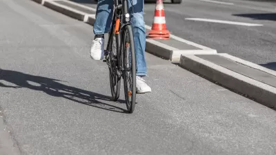
Southeast LA Road Safety Advocates Call for Improved Infrastructure
Streets in southeastern Los Angeles County have a severe lack of protected bike lanes and traffic safety measures, leading to high numbers of fatalities in a community where many residents depend on walking and biking for daily needs.

Minnesota Awards Active Transportation Grants
The grants are aimed at helping cities create action plans for improving their bike and pedestrian networks.
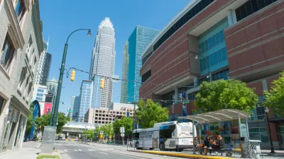
Charlotte Mobility Plan Centers Improved Multimodal Options and Economic Mobility
The city’s newly approved Strategic Mobility Plan highlights the need for better options when it comes to walking, biking, and public transit, setting a goal to reduce driving to half of total trips.

Planetizen Federal Action Tracker
A weekly monitor of how Trump’s orders and actions are impacting planners and planning in America.

Map: Where Senate Republicans Want to Sell Your Public Lands
For public land advocates, the Senate Republicans’ proposal to sell millions of acres of public land in the West is “the biggest fight of their careers.”

Restaurant Patios Were a Pandemic Win — Why Were They so Hard to Keep?
Social distancing requirements and changes in travel patterns prompted cities to pilot new uses for street and sidewalk space. Then it got complicated.

Maui's Vacation Rental Debate Turns Ugly
Verbal attacks, misinformation campaigns and fistfights plague a high-stakes debate to convert thousands of vacation rentals into long-term housing.

San Francisco Suspends Traffic Calming Amidst Record Deaths
Citing “a challenging fiscal landscape,” the city will cease the program on the heels of 42 traffic deaths, including 24 pedestrians.

California Homeless Arrests, Citations Spike After Ruling
An investigation reveals that anti-homeless actions increased up to 500% after Grants Pass v. Johnson — even in cities claiming no policy change.
Urban Design for Planners 1: Software Tools
This six-course series explores essential urban design concepts using open source software and equips planners with the tools they need to participate fully in the urban design process.
Planning for Universal Design
Learn the tools for implementing Universal Design in planning regulations.
Heyer Gruel & Associates PA
JM Goldson LLC
Custer County Colorado
City of Camden Redevelopment Agency
City of Astoria
Transportation Research & Education Center (TREC) at Portland State University
Camden Redevelopment Agency
City of Claremont
Municipality of Princeton (NJ)