


The city’s newly approved Strategic Mobility Plan highlights the need for better options when it comes to walking, biking, and public transit, setting a goal to reduce driving to half of total trips.
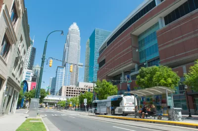
Charlotte, North Carolina’s city council has approved a Strategic Mobility Plan that seeks to improve public transit options, reduce driving, eliminate traffic deaths, and increase economic mobility for public transit users. According to an article in Smart Cities Dive by Austyn Gaffney, “That effort follows a 2014 study out of Harvard and the University of California, Berkeley that ranked Charlotte last out of the nation’s 50 largest commuting zones for intergenerational, or economically upward, mobility.”
“[At-large city council member Braxton Winston] said the next step for community input would be identifying and prioritizing individual projects that address the plan’s goals.” Meanwhile, the city needs support at the state level to levy a new tax to support the plan, which does not yet have dedicated funding sources.
Alvaro Villagran, director of federal programs for the Shared-Use Mobility Center, “said the Charlotte program follows a general trend of cities moving away from a highway-oriented or street management perspective on transportation to an integration of shared mobility options like public transit, electric vehicles, cycling and pedestrian use.” The plan includes a goal of shifting to a 50-50 mode share, where half of trips or fewer are taken by single-occupancy vehicle. According to Villagran, “Instead of just disincentivizing cars, he said, communities need to make alternative modes of mobility realistic options for residents.”
FULL STORY: Charlotte mobility plan aims to slash car use, transform access to lower-emission options

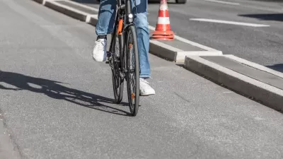
Southeast LA Road Safety Advocates Call for Improved Infrastructure
Streets in southeastern Los Angeles County have a severe lack of protected bike lanes and traffic safety measures, leading to high numbers of fatalities in a community where many residents depend on walking and biking for daily needs.
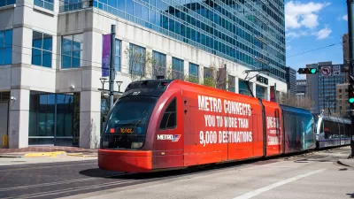
Houston Inches Toward Reduced Car Dependency
The city is investing more in biking, walking, and public transit, but a lack of funding and counterproductive moves from the Texas Department of Transportation are slowing the process of shifting away from personal automobile dependency.

The Business Case for Multimodal Transportation Planning
Travel demands are changing and so should planning. There are good reasons for communities to spend less on automobile facilities and more on walking, bicycling, and public transit. Let’s examine why.

Planetizen Federal Action Tracker
A weekly monitor of how Trump’s orders and actions are impacting planners and planning in America.

Chicago’s Ghost Rails
Just beneath the surface of the modern city lie the remnants of its expansive early 20th-century streetcar system.

San Antonio and Austin are Fusing Into one Massive Megaregion
The region spanning the two central Texas cities is growing fast, posing challenges for local infrastructure and water supplies.

Since Zion's Shuttles Went Electric “The Smog is Gone”
Visitors to Zion National Park can enjoy the canyon via the nation’s first fully electric park shuttle system.

Trump Distributing DOT Safety Funds at 1/10 Rate of Biden
Funds for Safe Streets and other transportation safety and equity programs are being held up by administrative reviews and conflicts with the Trump administration’s priorities.

German Cities Subsidize Taxis for Women Amid Wave of Violence
Free or low-cost taxi rides can help women navigate cities more safely, but critics say the programs don't address the root causes of violence against women.
Urban Design for Planners 1: Software Tools
This six-course series explores essential urban design concepts using open source software and equips planners with the tools they need to participate fully in the urban design process.
Planning for Universal Design
Learn the tools for implementing Universal Design in planning regulations.
planning NEXT
Appalachian Highlands Housing Partners
Mpact (founded as Rail~Volution)
City of Camden Redevelopment Agency
City of Astoria
City of Portland
City of Laramie