


A new report released by the Federal Railroad Administration outlines more than a dozen alternatives for upgrading passenger rail service throughout the Northeast Corridor, including what high-speed rail between D.C. and Boston could look like.
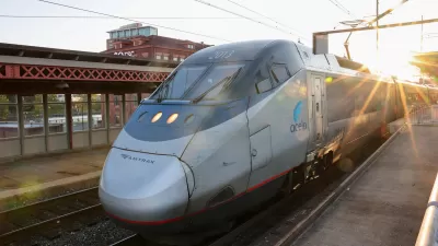
Kate Hinds looks as some of the 15 alternatives for investment in the 457-mile Northeast Corridor included in a new report, titled "NEC FUTURE," that was released this week by the Federal Railroad Administration (FRA). Alternatives run the gamut from simply bringing the route up to a state of good repair to the ambitious plan for building a separate dedicated high-speed rail line throughout the corridor.
According to Hinds, "The report aims to jump-start public debate about how rail capacity should be shaped in the region."
“It is intended to be the foundation for future investments in the Northeast Corridor, a 150 year-old alignment that has guided the growth of what is now one of the most densely populated transportation corridors in the world,” said Rebecca Reyes-Alicea, NEC FUTURE program manager for the Federal Railroad Administration. “(It) will further the dialogue about the rail network in the Northeast and how it can best serve us over for the years ahead.”
"Over the next year, these 15 options will be winnowed down," adds Hinds. "The federal government wants to have a single alternative in place by 2015."
FULL STORY: Feds Posit Ambitious Plan for Northeast High Speed Rail

The Passenger Rail Revival Is Here
For the first time in decades, multiple rail projects are moving forward that could have a transformative impact on train travel in the United States.
Texas Central High-Speed Rail Gets Green Light From Feds
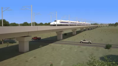
The Federal Railroad Administration has granted two key permissions for Texas Central to operate a high-speed trail between Houston and Dallas.
High-Speed Rail Connecting Atlanta to Charlotte Studied
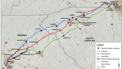
The Georgia Department of Transportation and the Federal Railroad Administration recently released a draft study of a plan to link Atlanta and Charlotte via high-speed rail.

Planetizen Federal Action Tracker
A weekly monitor of how Trump’s orders and actions are impacting planners and planning in America.

Map: Where Senate Republicans Want to Sell Your Public Lands
For public land advocates, the Senate Republicans’ proposal to sell millions of acres of public land in the West is “the biggest fight of their careers.”

Restaurant Patios Were a Pandemic Win — Why Were They so Hard to Keep?
Social distancing requirements and changes in travel patterns prompted cities to pilot new uses for street and sidewalk space. Then it got complicated.

Platform Pilsner: Vancouver Transit Agency Releases... a Beer?
TransLink will receive a portion of every sale of the four-pack.

Toronto Weighs Cheaper Transit, Parking Hikes for Major Events
Special event rates would take effect during large festivals, sports games and concerts to ‘discourage driving, manage congestion and free up space for transit.”

Berlin to Consider Car-Free Zone Larger Than Manhattan
The area bound by the 22-mile Ringbahn would still allow 12 uses of a private automobile per year per person, and several other exemptions.
Urban Design for Planners 1: Software Tools
This six-course series explores essential urban design concepts using open source software and equips planners with the tools they need to participate fully in the urban design process.
Planning for Universal Design
Learn the tools for implementing Universal Design in planning regulations.
Heyer Gruel & Associates PA
JM Goldson LLC
Custer County Colorado
City of Camden Redevelopment Agency
City of Astoria
Transportation Research & Education Center (TREC) at Portland State University
Camden Redevelopment Agency
City of Claremont
Municipality of Princeton (NJ)