


For decades, researchers have hunted for an explanation for why big cities have been more prone to violent crime than small ones. A new hypothesis may offer a surprising answer, and prove that big cities aren't inherently much more dangerous.

Researchers have offered several potential explanations for historically higher rates of violent crime in big cities: from the idea that there's more valuable stuff to steal in big cities to the rise of the crack epidemic. Even if other potential reasons strike you, you probably haven't considered a new persuasive hypothesis: exposure to gasoline lead. In an article for Mother Jones and in a follow-up blog piece, Kevin Drum examines the connection between lead exposure and crime.
"In a nutshell, the lead-crime hypothesis is simple: exposure to gasoline lead in small children produces heightened aggressive tendencies. When an entire generation of children was exposed to lead in the 40s, 50s, and 60s, thanks to the boom in auto sales after World War II, it led to a huge rise in violent crime when the children grew up in the 60s, 70s, and 80s. The more lead they were exposed to, the more crime you got."
"So where did we see the most exposure to gasoline lead? Answer: in places with the densest concentration of automobiles. And that's in the inner core of big cities. In the early 60s, big cities had double the ambient air lead levels of mid-size cities, which in turn had air lead levels 40 percent higher than small cities. (Nevin, p. 316.) So if lead exposure produces a rise in crime, you'd expect to see a bigger rise in big cities than in small ones. Over time, big cities would become increasingly more dangerous than small ones."
"Likewise, when lead was removed from gasoline, and children started to grow up normally, you'd expect to see a bigger crime decrease in big cities. Over time, crime rates would start to converge."
"And that's exactly what we see in the data."
"Only gasoline lead," concludes Drum in his article, "with its dramatic rise and fall following World War II, can explain the equally dramatic rise and fall in violent crime."
FULL STORY: Are Big Cities More Dangerous Than Small Ones?

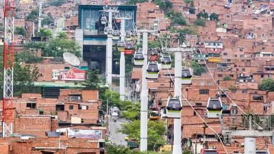
Infrastructure Investment for Public Safety: Lessons from Medellín
A natural experiment in Medellín indicates that infrastructural investments can reduce crime and improve perceptions of public safety.
The Chemistry of Safer, Denser Cities
While the middle class sought the refuge in the suburbs in the 1960s and 1970s, it turns out that the crime they were fleeing had nothing to do with density, race, or even blight. Mother Jones magazine suggest that it was all because of lead.
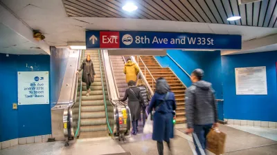
In Both Crashes and Crime, Public Transportation is Far Safer than Driving
Contrary to popular assumptions, public transportation has far lower crash and crime rates than automobile travel. For safer communities, improve and encourage transit travel.

Planetizen Federal Action Tracker
A weekly monitor of how Trump’s orders and actions are impacting planners and planning in America.

Map: Where Senate Republicans Want to Sell Your Public Lands
For public land advocates, the Senate Republicans’ proposal to sell millions of acres of public land in the West is “the biggest fight of their careers.”

Restaurant Patios Were a Pandemic Win — Why Were They so Hard to Keep?
Social distancing requirements and changes in travel patterns prompted cities to pilot new uses for street and sidewalk space. Then it got complicated.

Platform Pilsner: Vancouver Transit Agency Releases... a Beer?
TransLink will receive a portion of every sale of the four-pack.

Toronto Weighs Cheaper Transit, Parking Hikes for Major Events
Special event rates would take effect during large festivals, sports games and concerts to ‘discourage driving, manage congestion and free up space for transit.”

Berlin to Consider Car-Free Zone Larger Than Manhattan
The area bound by the 22-mile Ringbahn would still allow 12 uses of a private automobile per year per person, and several other exemptions.
Urban Design for Planners 1: Software Tools
This six-course series explores essential urban design concepts using open source software and equips planners with the tools they need to participate fully in the urban design process.
Planning for Universal Design
Learn the tools for implementing Universal Design in planning regulations.
Heyer Gruel & Associates PA
JM Goldson LLC
Custer County Colorado
City of Camden Redevelopment Agency
City of Astoria
Transportation Research & Education Center (TREC) at Portland State University
Camden Redevelopment Agency
City of Claremont
Municipality of Princeton (NJ)