


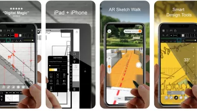
Lissette Valdez looks at two new applications that are helping to blur the lines between digital and hand drawn designs.
New applications may demonstrate that the supposed "death of drawing" in the architectural design process at the hands of computers, as diagnosed by architect Michael Graves in a recent Times op-ed, may be premature.
As Valdez notes, "the Trace app from the
Morpholio Project allows users to draw-with a stylus or a finger-over
digitized manilla-yellow tracing paper and sketch graphic concepts
directly onto an iPad screen. Designers can add new layers of Trace,
creating a timeline for the design process and allowing for easy sharing
between colleagues."
The second app, UrbaSee, "turns mobile devices into viewing windows that reveals a digital 3-D
scale model of a project when viewing the original plan through the
screen, tethering the virtual image to the tabletop plan. By using
georeferenced files and the device's GPS, UrbaSee can also display
models on the intended construction location."
FULL STORY: Two New Apps Change the Way Designers See Architecture

Best Apps for Urban Planning in 2022
Mobile apps continue to redefine the practices of planning—urban planning, regional planning, transportation planning, community planning, and rural planning included.
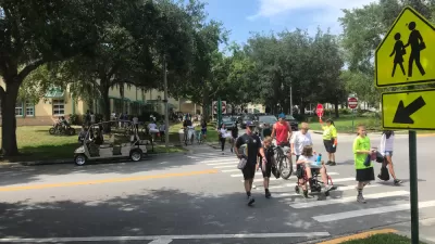
Earn Rewards for Traveling for by Foot, Bike, Bus, or Train
The city of Orlando is partnering with the Miles app.
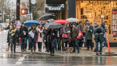
A New App Helps Identify 15-Minute City
The new 15-Minute City App generates maps which show the number of services and activities within a 15 minute walk, and and therefore whether an area can be considered a 15-minute neighborhood.

Planetizen Federal Action Tracker
A weekly monitor of how Trump’s orders and actions are impacting planners and planning in America.

Map: Where Senate Republicans Want to Sell Your Public Lands
For public land advocates, the Senate Republicans’ proposal to sell millions of acres of public land in the West is “the biggest fight of their careers.”

Restaurant Patios Were a Pandemic Win — Why Were They so Hard to Keep?
Social distancing requirements and changes in travel patterns prompted cities to pilot new uses for street and sidewalk space. Then it got complicated.

Platform Pilsner: Vancouver Transit Agency Releases... a Beer?
TransLink will receive a portion of every sale of the four-pack.

Toronto Weighs Cheaper Transit, Parking Hikes for Major Events
Special event rates would take effect during large festivals, sports games and concerts to ‘discourage driving, manage congestion and free up space for transit.”

Berlin to Consider Car-Free Zone Larger Than Manhattan
The area bound by the 22-mile Ringbahn would still allow 12 uses of a private automobile per year per person, and several other exemptions.
Urban Design for Planners 1: Software Tools
This six-course series explores essential urban design concepts using open source software and equips planners with the tools they need to participate fully in the urban design process.
Planning for Universal Design
Learn the tools for implementing Universal Design in planning regulations.
Heyer Gruel & Associates PA
JM Goldson LLC
Custer County Colorado
City of Camden Redevelopment Agency
City of Astoria
Transportation Research & Education Center (TREC) at Portland State University
Camden Redevelopment Agency
City of Claremont
Municipality of Princeton (NJ)