


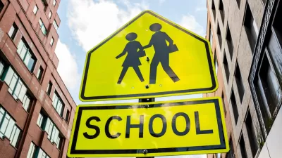
Low income people are more likely to get hit by cars. Kate Hinds reports on the social and infrastructural factors responsible for the disparity.
In Newark, New Jersey, about 500 pedestrians collide with vehicles each year. Dr. David Livingston, chief trauma surgeon at the University Hospital in Newark, sees about 300 of them. Due to this high accident rate, Newark, along with several other cities, has been dubbed a "pedestrian safety focus city" by the federal government.
Research from Rutgers University has shown a strong correlation between low income neighborhoods and high pedestrian crash totals. Daniel Kravetz, who conducted the research as a graduate student, says "The higher the income level, the lower the likelihood for crashes to occur in an area." It may seem logical to conclude that the wealthier residents are equipped with cars and simply don't walk the streets of Newark as often. But Kate Hinds points out that pedestrian infrastructure is a major factor in the Newark accident rates. Intersections in many low income neighborhoods are lacking crosswalks, pedestrian signals, curb cuts and sidewalks.
Newark officials say they are committed to making improvements, however. They've dedicated $27 million dollars this year to bicycle and pedestrian safety improvements, an unprecedented amount according to the city's traffic manager. Educational outreach programs and red light traffic cameras to calm traffic are also in the plans to reduce pedestrian accidents.
Thanks to Jessica Brent
FULL STORY: Poor Pedestrians More Likely To Be Struck by Cars

Crosswalks Near NYC Schools More Dangerous Than Average
A child and a crossing guard were killed in school crosswalks within one week as the NYPD cuts crossing guard jobs.
Connecticut Launches Complete Streets Standards
The new policy calls for sidewalks, bike lanes, and crosswalks on state roads and state-funded road projects.
DIY Crosswalks Appear in Hollywood
A group claiming the city of Los Angeles fails to protect pedestrians is taking action on their own, painting a set of crosswalks at a busy residential intersection.

Planetizen Federal Action Tracker
A weekly monitor of how Trump’s orders and actions are impacting planners and planning in America.

Maui's Vacation Rental Debate Turns Ugly
Verbal attacks, misinformation campaigns and fistfights plague a high-stakes debate to convert thousands of vacation rentals into long-term housing.

San Francisco Suspends Traffic Calming Amidst Record Deaths
Citing “a challenging fiscal landscape,” the city will cease the program on the heels of 42 traffic deaths, including 24 pedestrians.

Defunct Pittsburgh Power Plant to Become Residential Tower
A decommissioned steam heat plant will be redeveloped into almost 100 affordable housing units.

Trump Prompts Restructuring of Transportation Research Board in “Unprecedented Overreach”
The TRB has eliminated more than half of its committees including those focused on climate, equity, and cities.

Amtrak Rolls Out New Orleans to Alabama “Mardi Gras” Train
The new service will operate morning and evening departures between Mobile and New Orleans.
Urban Design for Planners 1: Software Tools
This six-course series explores essential urban design concepts using open source software and equips planners with the tools they need to participate fully in the urban design process.
Planning for Universal Design
Learn the tools for implementing Universal Design in planning regulations.
Heyer Gruel & Associates PA
JM Goldson LLC
Custer County Colorado
City of Camden Redevelopment Agency
City of Astoria
Transportation Research & Education Center (TREC) at Portland State University
Jefferson Parish Government
Camden Redevelopment Agency
City of Claremont