


Winter storms have combined with bad road engineering, geography, funding shortfalls and inequities in Sonoma County, California. drivers and cyclists can expect an unusually rough ride this year and more to come.
For six years the county has received the dubious transportation title of having the worst of the Bay Area's (9-county-region) roads. This year, funding shortfalls have caused the Board of Supervisors to fund "paving upgrades for 150 miles of the most traveled roads and leaving the rest to degrade." It is in charge of a "1,384-mile network of rural roads, the Bay Area's largest."
The reason for the county's bad roads lie "partly with the weather. So far this winter, Sonoma County has received more than double last year's rainfall, leaving soaked roads vulnerable to hydraulic eruptions."
Additionally, "...officials say the perennial rash of potholes results from poor historic design." Many of the roads went from "cow paths to wagon trails to paved roads without ever receiving the kind of engineered base that gives a road strength."
Thanks to MTC Library
FULL STORY: Get ready for more potholes; Heavy rainfall expected to erode Sonoma County's ailing roads

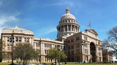
Lacking Funds for Repair, Texas Unpaves its Roads
Unable to find funding to repair roads damaged by the booming oil industry traffic, Texas will convert asphalt roads to gravel. Texas's gas tax is among the lowest in the nation.
Auto Repairs From Potholes Got You Down? You Are Not Alone
A new report from the AAA indicates that American motorists encounter damage from potholes three times a year, with each incident costing an average $300 to repair. Middle and working class drivers feel the pinch disproportionately.
Depaving Rural American Roads-Literally
Rather than being part of a car liberation or permeable pavement movement, poorly maintained county roads are having their asphalt ground into gravel as a cost-cutting measure to avoid costly road reconstruction. Lack of funding is the cause.

Maui's Vacation Rental Debate Turns Ugly
Verbal attacks, misinformation campaigns and fistfights plague a high-stakes debate to convert thousands of vacation rentals into long-term housing.

Planetizen Federal Action Tracker
A weekly monitor of how Trump’s orders and actions are impacting planners and planning in America.

San Francisco Suspends Traffic Calming Amidst Record Deaths
Citing “a challenging fiscal landscape,” the city will cease the program on the heels of 42 traffic deaths, including 24 pedestrians.

Defunct Pittsburgh Power Plant to Become Residential Tower
A decommissioned steam heat plant will be redeveloped into almost 100 affordable housing units.

Trump Prompts Restructuring of Transportation Research Board in “Unprecedented Overreach”
The TRB has eliminated more than half of its committees including those focused on climate, equity, and cities.

Amtrak Rolls Out New Orleans to Alabama “Mardi Gras” Train
The new service will operate morning and evening departures between Mobile and New Orleans.
Urban Design for Planners 1: Software Tools
This six-course series explores essential urban design concepts using open source software and equips planners with the tools they need to participate fully in the urban design process.
Planning for Universal Design
Learn the tools for implementing Universal Design in planning regulations.
Heyer Gruel & Associates PA
JM Goldson LLC
Custer County Colorado
City of Camden Redevelopment Agency
City of Astoria
Transportation Research & Education Center (TREC) at Portland State University
Jefferson Parish Government
Camden Redevelopment Agency
City of Claremont