


With vast technology in this information age we are oversaturated with data. The trouble is planners aren't using this information nearly as much as they could be when it comes to economic development in underserved neighborhoods. The transportation sector collects data on travel patterns, behavioral choices, and modal efficiencies. With GIS technology, we can map socio-economic patterns, predict how rising sea levels will change our coastline,and evaluate development patterns. We even have technology to create more efficient trash collection routes and track real time bus movement for bus travelers. But do planners have a sufficient databank of information to demonstrate demand and purchasing power in underserved neighborhoods? Are we perpetuating disinvestment in these communities by ignoring the data? If data begets knowledge and knowledge equals power, where does that leave us?
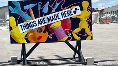
We all struggle with ways to attract investors into disinvested communities. In Florida, planners almost always turnto Community Redevelopment Agencies or CRAs, which use tax increment financing to provide gap funding for private developments in unproven markets. And why? Because the traditional data sources, like the U. S. Census and Claritis indicate that households in these disinvested neighborhoods have less purchasing power. And if your development is not a typical residential or commercial product, there simply isn't any industry analysis on its potential demand. These two factors limit investment and the types of investments in poorer neighborhoods. But, critical thinkers are challenging these limitations and finding creative ways to link data to develop a better understanding of how disinvested communities spend their money and how cultural and arts activities encourage investment.
The non-profit company Social Compact has evaluated overlooked economic indicators to demonstrate a neighborhood's economic health. They use real time transactional data to track the daily spending habits of communities and to calculate buying power using non-traditional data sources like tax assessment, building permits, utility usage, bill payments, and consumer expenditure. And their findings are quite extraordinary. They've discovered that in over 400 underserved urban neighborhoods there are nearly 1.25 million additional residents and more than $35 billion in unrecognized income-22% higher than census trend projections. This irrefutable data has given disinvested places the power to attract valuable neighborhood investment without having to provide gap funding. The results are more self-sustaining and self-sufficient neighborhoods.
The Reinvestment Fund (TRF), a Philadelphia based foundation which finances urban real estate, business, and provides data analysis, and Social Impact of the Arts Project (SIAP), a Philadelphia based non-profit policy research group concluded that community based culture and arts can and does encourage private investment, but there is insufficient data to confirm this and no clear method for measurement. SIAP has also revealed that economists are not measuring demand for cultural uses like artist housing, which has a different demand than conventional housing and is more likely to reuse older and underutilized buildings in disinvested neighborhoods. The SIAP study hypothsizes that developments like artist housing engage the community, help create community identity, and signal market renewal. More data research to measure this link between cultural activity and neighborhood development, like Social Compact's research, could empower neighborhoods to attract cultural investment.
Shouldn't planners and economists cultivate this less conventional approach to data collection in disinvested communities by demanding more thorough research and engaging non-profit organizations that are already developing this information? The benefits are astounding. Until then we are doing our communities a great disservice.


New York City's Dancing Prohibition Remains a Barrier to Entry, Equality
New York’s 1960s-era zoning code still prohibits dancing in small bars and restaurants in more than 80 percent of the city, but Mayor Eric Adams and advocates want to change that.

The Mobility-Productivity Paradox
New research shows that excessive vehicle travel reduces economic productivity, and that less mobility provides more productivity. Yes, you read that right.
Columbia’s Revitalized ‘Loop’ Is a Hub for Local Entrepreneurs
A focus on small businesses is helping a commercial corridor in Columbia, Missouri thrive.

Planetizen Federal Action Tracker
A weekly monitor of how Trump’s orders and actions are impacting planners and planning in America.

Restaurant Patios Were a Pandemic Win — Why Were They so Hard to Keep?
Social distancing requirements and changes in travel patterns prompted cities to pilot new uses for street and sidewalk space. Then it got complicated.

Map: Where Senate Republicans Want to Sell Your Public Lands
For public land advocates, the Senate Republicans’ proposal to sell millions of acres of public land in the West is “the biggest fight of their careers.”

Orange County, Florida Adopts Largest US “Sprawl Repair” Code
The ‘Orange Code’ seeks to rectify decades of sprawl-inducing, car-oriented development.

Maui's Vacation Rental Debate Turns Ugly
Verbal attacks, misinformation campaigns and fistfights plague a high-stakes debate to convert thousands of vacation rentals into long-term housing.

San Francisco Suspends Traffic Calming Amidst Record Deaths
Citing “a challenging fiscal landscape,” the city will cease the program on the heels of 42 traffic deaths, including 24 pedestrians.
Urban Design for Planners 1: Software Tools
This six-course series explores essential urban design concepts using open source software and equips planners with the tools they need to participate fully in the urban design process.
Planning for Universal Design
Learn the tools for implementing Universal Design in planning regulations.
Heyer Gruel & Associates PA
JM Goldson LLC
Custer County Colorado
City of Camden Redevelopment Agency
City of Astoria
Transportation Research & Education Center (TREC) at Portland State University
Camden Redevelopment Agency
City of Claremont
Municipality of Princeton (NJ)