


In an earlier post, I discussed the difference between mobility, accessibility, and transportation technology. In today’s post, I want to discuss what I think is the next step in this taxonomy in terms of the implications for the built environment and urban planning. More specifically, we need to move beyond the idea that certain transportation technologies—whether it is a car, a bus, a train, or our feet—are substitutes.

In an earlier post, I discussed the difference between mobility, accessibility, and transportation technology. In today's post, I want to discuss what I think is the next step in this taxonomy in terms of the implications for the built environment and urban planning. More specifically, we need to move beyond the idea that certain transportation technologies-whether it is a car, a bus, a train, or our feet-are substitutes. The real question is ensuring the right transportation technologies are in the right place at the right time to maximize accessibility while maximizing mobility within a cost-effective framework with minimal public subsidy.
Our (transportation consumers') interest in accessing goods and services will determine to a large degree the transportation technologies we use. Thus, in Manhattan (population density = 71,000 people per square mile), the dominant mode of obtaining access to goods and services is by foot. Manhattan, as we point out in our book Mobility First (Chapter 4), is a walking city. Public transit is also important (mostly rail but also bus), but this technology is suitable for destinations outside the immediate neighborhood not reaching destinations within a couple (or even several) blocks. Cars simply don't make sense for both mobility and personal cost reasons in these high-density settings.
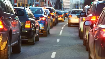
Across the East River, the transportation story is more complex. In Brooklyn (Population Density=35,000), choices of transportation technologies (also known as modes) are more evenly split between automobiles, public transit, and walking. In Queens (population density = 20,000), 60 percent of commuters travel by car. In Staten Island (population density = 7,500), 71 percent commute by car.
All this is rather academic, but the point is not the obvious one that the automobile is dominant in low-density settings. Rather, it's the transportation choice set changes depending on the character of the built environment. The danger is in thinking that transportation modes are perfect substitutes in terms of their ability to provide mobility and access in all urban settings. In short, adopting a blanket principle that communities benefit from have the greatest number of transportation choices is not necessarily true.
Ponder the following general rules of thumb. Automobiles are unquestionably the most flexible and adaptable, but they are neither the most popular not the most efficient choices for all settings. (Personal car trips make up less than 5 percent of all commuting trips in Manhattan, for example.) Cars, in low and medium-density settings are quite efficient for most people traveling distances of at least a mile or more (but less than several hundred). Walking, however, is quite effective for the vast majority of people for accessing destinations and points of less than a mile. It doesn't make sense (and most people don't) use the automobile to access services and goods with a few hundred feet or yards of where the live or work. (The exception, of course, is when safety might dictate the use of an alternative mode, whether walking or transit.) Bicycles, in the right context, provide an excellent point-to-point access for those traveling one to three miles. Public transit is typically most efficient for accessing destinations of three to ten miles as long as a direct route is available although the big downside to public transit is lack of point-to-point access to primary destinations and origins.
The kicker is that different built environments make different transportation modes relatively more (or less) effective and efficient (both in terms of social and private costs). Public transit simply can't provide meaningful alternatives for most people living and working in low-density suburban neighborhoods (with densities typically less than 5,000 people per square mile or less).
Since optimizing public transit is a fundamental value (perhaps even "objective" in the philosophical sense) for many professional planners, transportation policy proposals are almost always framed in the context of boosting public transit without a meaningful discussion of the implications for the built environment. The all too facile "answer" to low transit ridership is to densify neighborhoods to justify the expansion of transit, but this assumes that these higher densities will provide equivalent access to the services and goods people want.
This also implies a functional equivalency between built environments, as if, from a planning perspective, there is no meaningful lifestyle or quality of life difference between a Brooklyn-style neighborhood compared to a conventional suburban-style neighborhood (e.g., Staten Island). Yet, as any planner understands, these neighborhood styles are not functionally equivalent. As an empirical reality, households (in the U.S. or elsewhere) are not neutral with respect to their housing or neighborhood preferences.
Thus, when discussing mobility, accessibility and transportation technologies, planners should be cognizant of the reality that for most households moving to more dense, mixed use, Brooklyn-style neighborhoods-the ones that truly favor and optimize multimode transportation options-will also view this a dramatic shift in life style and quality of life. A functional and meaningful difference exists between living in a single-family home with a yard and an attached private garage versus a townhouse with curbside, open air parking and (optimistically) a sliver of personal open space. Similarly, a function and aesthetic difference exists between a three bedroom, two-bath ranch house and open floor plan, and a narrow, stacked row house with three bedrooms and two bathrooms. In most cases, travel times and the complexity of travel necessary to access goods and services will increase as well.
As I have mentioned previously, mobility is a normal economic good, which means the demand for greater mobility increases with income. Shifting households to neighborhoods that require alternative transportation modes that are more cumbersome, complex, and time intensive will require compensating urban amenities that offsets these disadvantages. Otherwise, society and communities suffer.

USDOT Releases Climate Strategies Playbook
The USDOT's new Climate Strategies that Work Playbook provides detailed information concerning benefits and implementation requirements for 27 transportation-related emission reduction strategies.
Calculating Vehicle Travel Reduction Benefits
The Rocky Mountain Institute's new Smarter MODES Calculator quantifies economic, social and environmental benefits provided by shifts from automobile travel to more resource-efficient modes. This includes benefits that are often overlooked or undervalued in conventional planning.

Sioux Falls Multi-Family Development Outpaces Transportation Improvements
Sioux Falls, South Dakota is undergoing a multi-family development boom. Residents are increasingly concerned about the traffic the development brings, according to local news reports.

Planetizen Federal Action Tracker
A weekly monitor of how Trump’s orders and actions are impacting planners and planning in America.

Map: Where Senate Republicans Want to Sell Your Public Lands
For public land advocates, the Senate Republicans’ proposal to sell millions of acres of public land in the West is “the biggest fight of their careers.”

Restaurant Patios Were a Pandemic Win — Why Were They so Hard to Keep?
Social distancing requirements and changes in travel patterns prompted cities to pilot new uses for street and sidewalk space. Then it got complicated.

Platform Pilsner: Vancouver Transit Agency Releases... a Beer?
TransLink will receive a portion of every sale of the four-pack.

Toronto Weighs Cheaper Transit, Parking Hikes for Major Events
Special event rates would take effect during large festivals, sports games and concerts to ‘discourage driving, manage congestion and free up space for transit.”

Berlin to Consider Car-Free Zone Larger Than Manhattan
The area bound by the 22-mile Ringbahn would still allow 12 uses of a private automobile per year per person, and several other exemptions.
Urban Design for Planners 1: Software Tools
This six-course series explores essential urban design concepts using open source software and equips planners with the tools they need to participate fully in the urban design process.
Planning for Universal Design
Learn the tools for implementing Universal Design in planning regulations.
Heyer Gruel & Associates PA
JM Goldson LLC
Custer County Colorado
City of Camden Redevelopment Agency
City of Astoria
Transportation Research & Education Center (TREC) at Portland State University
Camden Redevelopment Agency
City of Claremont
Municipality of Princeton (NJ)