


Extensive investments in rail are slashing travel times in China, and creating a vastly more connected and accessible country.
"Over the next three years, the government will pour some $300 billion into its railways, expanding its network by 20,000 kilometers, including 13,000 kilometers of track designed for high-speed trains capable of traveling up to 350kph. Result: China, a nation long defined by the vastness of its geography, is getting, much, much smaller.
Already, the journey from Beijing to Taiyuan, the capital of Shanxi province, has been slashed from eight hours to three. Shortly before the Olympics last year, the 120km trip from Beijing to Tianjin was cut from almost an hour to just 27 minutes. In the next few years, a train journey from Wuhan to Guangzhou, halfway across the country, will shrink from 10 to three hours. The trip from Shanghai to Beijing, which currently clocks in at 10 grueling hours-and twice that, not so long ago-will be cut to just four, making train travel between China's two most important cities a viable competitor to air for the first time. Similarly, a trip from the capital to the southern manufacturing powerhouse of Guangzhou-more or less the entire length of the nation-will take just eight hours, compared with 20 before and more than a day and a half by bus."
Officials are hoping the increased interconnectedness will enable a greater distribution of economic development opportunities.
FULL STORY: The Shrinking of China

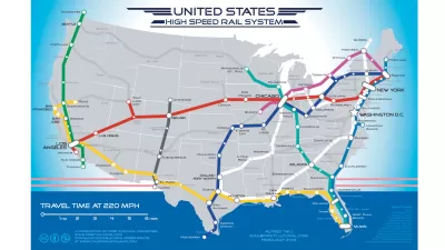
How Can Rail Complete its Comeback in the United States?
Deepa Sanyal writes the second installment of a series devoted to the idea of "Rail Redux"—this time examining the question of what components are necessary to drive a "true rail resurgence."
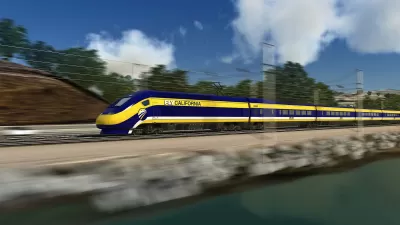
California High Speed Rail Update
The San Francisco Planning and Urban Research Center offers good news about California's slow-to-start high speed rail.
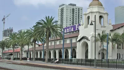
San Diego's Omission from High-Speed Rail: Customary Curse or Blessing in Disguise?
Is California's High-Speed Rail (HSR) a "boondoggle" for the state, as its critics assert, or just a boondoggle for omitted cities? How should such cities deal with omission from HSR? San Diego is a case in point.

Planetizen Federal Action Tracker
A weekly monitor of how Trump’s orders and actions are impacting planners and planning in America.

Map: Where Senate Republicans Want to Sell Your Public Lands
For public land advocates, the Senate Republicans’ proposal to sell millions of acres of public land in the West is “the biggest fight of their careers.”

Restaurant Patios Were a Pandemic Win — Why Were They so Hard to Keep?
Social distancing requirements and changes in travel patterns prompted cities to pilot new uses for street and sidewalk space. Then it got complicated.

Platform Pilsner: Vancouver Transit Agency Releases... a Beer?
TransLink will receive a portion of every sale of the four-pack.

Toronto Weighs Cheaper Transit, Parking Hikes for Major Events
Special event rates would take effect during large festivals, sports games and concerts to ‘discourage driving, manage congestion and free up space for transit.”

Berlin to Consider Car-Free Zone Larger Than Manhattan
The area bound by the 22-mile Ringbahn would still allow 12 uses of a private automobile per year per person, and several other exemptions.
Urban Design for Planners 1: Software Tools
This six-course series explores essential urban design concepts using open source software and equips planners with the tools they need to participate fully in the urban design process.
Planning for Universal Design
Learn the tools for implementing Universal Design in planning regulations.
Heyer Gruel & Associates PA
JM Goldson LLC
Custer County Colorado
City of Camden Redevelopment Agency
City of Astoria
Transportation Research & Education Center (TREC) at Portland State University
Camden Redevelopment Agency
City of Claremont
Municipality of Princeton (NJ)