


Decades of massive hydrologic engineering have altered California's ecology out of equilibrium and will be unable to support present demands, warns Rachel Olivieri.
"California has spared no expense to either taxpayers or natural ecosystems to attain its status as the most hydrologically altered landmass on the planet. About 42 MAF of the state's runoff is captured and diverted through six major systems of reservoirs and aqueducts...Nine out of every ten acres of riparian woodlands are gone, along with ten thousand grizzly bears that once roamed the valleys and foothills. The loss of mega and micro flora and fauna is beyond counting.
The Bay Delta, the confluence of the Sacramento and San Joaquin rivers...is not on the verge of collapse, it is collapsing. Historic flows from the Delta to the Bay have been reduced by half, increasing saltwater intrusion into the freshwater system.
Without considering global warming, a century from now all man-made reservoirs that are not full of silt will nonetheless have lost their operational capacities to support agriculture, prevent floods, and serve human population centers.
California's water infrastructure is aging and degenerating. The older it gets, the more problems it has. The massively altered watersheds, accumulating the burdens of dams and diversions, have lost the stability of equilibrium."
FULL STORY: Is California on the Brink of Environmental Collapse?


Creating Ocean-Safe Plastic from Seashells
USC researchers have created a biodegradable, marine-safe plastic alternative using calcium carbonate from seashells, offering a promising solution to ocean pollution.

Commentary: Colorado Will Forge Ahead With Conservation Work
While federal policy may become less friendly to environmental efforts, support from state legislators and agencies can prevent the state from backsliding.
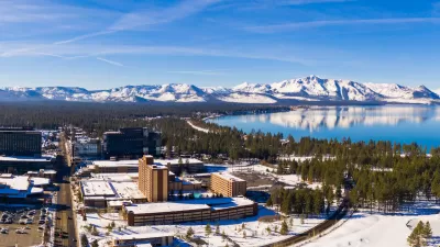
Nevada to Host National Outdoor Recreation Conference
In May 2024, the Society of Outdoor Recreation Professionals will hold its national conference in Stateline, Nevada, offering opportunities to learn and network in the beautiful setting of Lake Tahoe.

Planetizen Federal Action Tracker
A weekly monitor of how Trump’s orders and actions are impacting planners and planning in America.

Map: Where Senate Republicans Want to Sell Your Public Lands
For public land advocates, the Senate Republicans’ proposal to sell millions of acres of public land in the West is “the biggest fight of their careers.”

Restaurant Patios Were a Pandemic Win — Why Were They so Hard to Keep?
Social distancing requirements and changes in travel patterns prompted cities to pilot new uses for street and sidewalk space. Then it got complicated.

Platform Pilsner: Vancouver Transit Agency Releases... a Beer?
TransLink will receive a portion of every sale of the four-pack.

Toronto Weighs Cheaper Transit, Parking Hikes for Major Events
Special event rates would take effect during large festivals, sports games and concerts to ‘discourage driving, manage congestion and free up space for transit.”

Berlin to Consider Car-Free Zone Larger Than Manhattan
The area bound by the 22-mile Ringbahn would still allow 12 uses of a private automobile per year per person, and several other exemptions.
Urban Design for Planners 1: Software Tools
This six-course series explores essential urban design concepts using open source software and equips planners with the tools they need to participate fully in the urban design process.
Planning for Universal Design
Learn the tools for implementing Universal Design in planning regulations.
Heyer Gruel & Associates PA
JM Goldson LLC
Custer County Colorado
City of Camden Redevelopment Agency
City of Astoria
Transportation Research & Education Center (TREC) at Portland State University
Camden Redevelopment Agency
City of Claremont
Municipality of Princeton (NJ)