


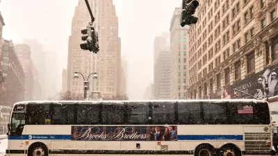
In an effort to increase livability, New York City will test a 6.9 mile car-free corridor during the month of August.
"It has been a long-held dream of New Yorkers of a certain (greenish) stripe: the streets of Manhattan free of cars. Now, for a few hours, on a few streets, on a few weekends this summer, that dream will become reality.
Mayor Michael R. Bloomberg announced on Monday that he will create a car-free zone on three Saturdays in August, along a 6.9-mile stretch of streets through Manhattan, from the Brooklyn Bridge, north to Park Avenue and the Upper East Side. Cars, trucks and buses will be banned on the streets along the route from 7 a.m. to 1 p.m. on Aug. 9, 16 and 23. The mayor was careful to describe the initiative, called Summer Streets, as an experiment.
'If it works, we'll certainly consider doing it again,' Mr. Bloomberg said, at a news conference in the East Village on Lafayette Street, which will be included in the route. 'If not, we won't. But we have never been afraid to try new ideas, especially the ones that have the potential to improve the quality of life.'"
FULL STORY: On 3 Days in August, City Will Try No-Car Zone

Car-Free Days Planned for New York
New York Mayor Michael Bloomberg has announced plans for car-free days on a nearly 7-mile section of road in Manhattan.

Safe Streets Ballot Measure Runs Into Unexpected Opposition
Los Angeles's Measure HLA would compel the city to make serious upgrades for walking, biking, and other forms of active transportation, all in the name of saving lives. Its biggest opponent: the firefighters union.
Visions of a Car-Free Manhattan
In Manhattan, the space devoted to cars and car-related infrastructure takes up an area four times larger than Central Park. What would New York City look like if it divested from cars?

Maui's Vacation Rental Debate Turns Ugly
Verbal attacks, misinformation campaigns and fistfights plague a high-stakes debate to convert thousands of vacation rentals into long-term housing.

Planetizen Federal Action Tracker
A weekly monitor of how Trump’s orders and actions are impacting planners and planning in America.

In Urban Planning, AI Prompting Could be the New Design Thinking
Creativity has long been key to great urban design. What if we see AI as our new creative partner?

King County Supportive Housing Program Offers Hope for Unhoused Residents
The county is taking a ‘Housing First’ approach that prioritizes getting people into housing, then offering wraparound supportive services.

Researchers Use AI to Get Clearer Picture of US Housing
Analysts are using artificial intelligence to supercharge their research by allowing them to comb through data faster. Though these AI tools can be error prone, they save time and housing researchers are optimistic about the future.

Making Shared Micromobility More Inclusive
Cities and shared mobility system operators can do more to include people with disabilities in planning and operations, per a new report.
Urban Design for Planners 1: Software Tools
This six-course series explores essential urban design concepts using open source software and equips planners with the tools they need to participate fully in the urban design process.
Planning for Universal Design
Learn the tools for implementing Universal Design in planning regulations.
planning NEXT
Appalachian Highlands Housing Partners
Mpact (founded as Rail~Volution)
City of Camden Redevelopment Agency
City of Astoria
City of Portland
City of Laramie