


In Manhattan, the space devoted to cars and car-related infrastructure takes up an area four times larger than Central Park. What would New York City look like if it divested from cars?
Farhad Manjoo has a vision for a car-free Manhattan. Manjoo's recent New York Times piece features scrolling animations that artfully elucidate the borough's dependence on cars as a personal means of transportation. Also included: a 45-minute long video of Manjoo discussing all things cars in the recent past, the present, and the future.
Streets fell silent at the onset of the coronavirus lockdown. "Rather than stumble back into car dependency, cities can begin to undo their worst mistake: giving up so much of their land to the automobile," writes Mandoo. Mandoo's piece presents a vision of walkable, biker friendly Manhattan streets with illustrations courtesy of the Practice for Architecture and Urbanism, answering the question, "What if we gave that space back to New Yorkers?"
FULL STORY: I’ve Seen a Future Without Cars, and It’s Amazing


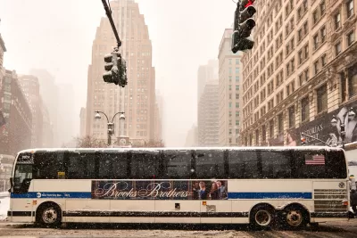
New York Subway Sets Pandemic Ridership Record
With school back in session and Broadway shows open to the public, subway ridership is surging in New York City, but still well below pre-pandemic levels.

Will Cuomo Save Transit in New York?
Assuming that Congress isn't going to act, does New York Gov Cuomo have the political will to save the New York MTA from sweeping layoffs and service cuts?
Report: New York MTA Facing 'Greatest Crisis' in its History
A new report on the finances of the New York Metropolitan Transportation Authority (MTA) makes a desperate plea for assistance from the federal government.

Maui's Vacation Rental Debate Turns Ugly
Verbal attacks, misinformation campaigns and fistfights plague a high-stakes debate to convert thousands of vacation rentals into long-term housing.

Planetizen Federal Action Tracker
A weekly monitor of how Trump’s orders and actions are impacting planners and planning in America.

In Urban Planning, AI Prompting Could be the New Design Thinking
Creativity has long been key to great urban design. What if we see AI as our new creative partner?

King County Supportive Housing Program Offers Hope for Unhoused Residents
The county is taking a ‘Housing First’ approach that prioritizes getting people into housing, then offering wraparound supportive services.

Researchers Use AI to Get Clearer Picture of US Housing
Analysts are using artificial intelligence to supercharge their research by allowing them to comb through data faster. Though these AI tools can be error prone, they save time and housing researchers are optimistic about the future.

Making Shared Micromobility More Inclusive
Cities and shared mobility system operators can do more to include people with disabilities in planning and operations, per a new report.
Urban Design for Planners 1: Software Tools
This six-course series explores essential urban design concepts using open source software and equips planners with the tools they need to participate fully in the urban design process.
Planning for Universal Design
Learn the tools for implementing Universal Design in planning regulations.
planning NEXT
Appalachian Highlands Housing Partners
Mpact (founded as Rail~Volution)
City of Camden Redevelopment Agency
City of Astoria
City of Portland
City of Laramie