


A national study shows, once again, that increasing road supply induces additional vehicle travel, particularly over the long run.
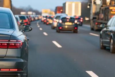
A new study, Road Capacity as a Fundamental Determinant of Vehicle Travel, published by the University of California Institute of Transportation Studies, indicates that roadway supply is a key factor affecting the amount that people drive in a community. It uses U.S. national data to analyze factors that affect vehicle travel. It finds that road capacity has a larger effect on per capita VMT than factors traditionally considered, such as income and fuel prices. This provides aggregate evidence that roadway expansions induce additional vehicle travel, particularly over the long run.
Road supply does not just affect traffic speeds and automobile accessibility but also impacts pedestrian connectivity, land development, transit service feasibility, plus household residential and employment location decisions. The researchers point out that per capita vehicle travel peaked early in the Twenty First Century so road capacity rather than income or fuel price has emerged as the fundamental factor affecting vehicle travel.
The study concludes that achieving VMT reduction targets are likely to require road capacity reductions.
FULL STORY: Road Capacity as a Fundamental Determinant of Vehicle Travel

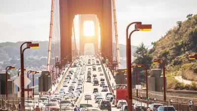
San Francisco ‘Best-Performing Metro’ for VMT, Traffic Reduction
The city saw a 13 percent drop in miles driven per capita in the last five years.

From 9-to-5 to Anytime: How Telecommuting Changes the Traffic Game
Not all cities have benefited equally from congestion relief brought on by shifting commuting patterns.
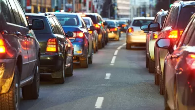
Report: Americans Are Driving More Than Ever
Average vehicle miles driven rose in almost every major metropolitan area between 2019 and 2024.

Planetizen Federal Action Tracker
A weekly monitor of how Trump’s orders and actions are impacting planners and planning in America.

DARTSpace Platform Streamlines Dallas TOD Application Process
The Dallas transit agency hopes a shorter permitting timeline will boost transit-oriented development around rail stations.

Four Reasons Urban Planners Can’t Ignore AI
It’s no longer a question of whether AI will shape planning, but how. That how is up to us.

Supreme Court Ruling in Pipeline Case Guts Federal Environmental Law
The decision limits the scope of a federal law that mandates extensive environmental impact reviews of energy, infrastructure, and transportation projects.

Texas State Bills to Defund Dallas Transit Die
DART would have seen a 30% service cut, $230M annual losses had the bills survived.

Bikeshare for the Win: Team Pedals to London Cricket Match, Beats Rivals Stuck in Traffic
While their opponents sat in gridlock, England's national cricket team hopped Lime bikes, riding to a 3-0 victory.
Urban Design for Planners 1: Software Tools
This six-course series explores essential urban design concepts using open source software and equips planners with the tools they need to participate fully in the urban design process.
Planning for Universal Design
Learn the tools for implementing Universal Design in planning regulations.
City of Mt Shasta
City of Camden Redevelopment Agency
City of Astoria
Transportation Research & Education Center (TREC) at Portland State University
US High Speed Rail Association
City of Camden Redevelopment Agency
Municipality of Princeton (NJ)