


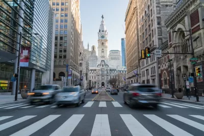
Speeding violations on streets with automated traffic enforcement are down by 95 percent, according to city officials.
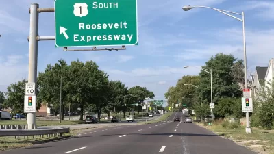
Following the success of its first deployment of traffic enforcement cameras, Philadelphia plans to add 42 new cameras on segments of Route 13, the second most dangerous state route in the city reports Tom MacDonald for WHYY.
“Since installing speed cameras on Roosevelt Boulevard, city officials say speeding violations are down 95%. Fatal and serious injury crashes are down 21%, and crashes involving pedestrians are down 50%.” City officials used this data to refute claims that speed cameras are just a “cash grab” aimed at generating revenue.
According to MacDonald, “The city will also start a pilot program for speed cameras in school zones. There’s also another bill to put cameras on dangerous corners that will soon go before City Council.” Additionally, Mayor Cherelle Parker said “the city would advocate with the state to lift the cap on the number of corners where they can add speed cameras.”
FULL STORY: More speed cameras coming to Philadelphia streets

Philadelphia’s Speed Cameras Are Working
Speeding violations plummeted after automated enforcement cameras were installed along Roosevelt Boulevard.
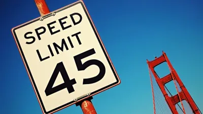
San Francisco Turns On California’s First Speed Cameras
The city is the first in the state to use automated traffic enforcement to reduce speeding and traffic deaths.
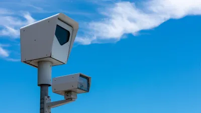
Data Shows Chicago Speed Cameras Reduce Speeding, Crashes
Countering claims made by the Chicago Tribune that automated enforcement doesn’t improve safety, Streetsblog Chicago lays out the data showing how traffic safety fared in camera zones.

Planetizen Federal Action Tracker
A weekly monitor of how Trump’s orders and actions are impacting planners and planning in America.

Map: Where Senate Republicans Want to Sell Your Public Lands
For public land advocates, the Senate Republicans’ proposal to sell millions of acres of public land in the West is “the biggest fight of their careers.”

Restaurant Patios Were a Pandemic Win — Why Were They so Hard to Keep?
Social distancing requirements and changes in travel patterns prompted cities to pilot new uses for street and sidewalk space. Then it got complicated.

San Francisco Suspends Traffic Calming Amidst Record Deaths
Citing “a challenging fiscal landscape,” the city will cease the program on the heels of 42 traffic deaths, including 24 pedestrians.

California Homeless Arrests, Citations Spike After Ruling
An investigation reveals that anti-homeless actions increased up to 500% after Grants Pass v. Johnson — even in cities claiming no policy change.

Albuquerque Route 66 Motels Become Affordable Housing
A $4 million city fund is incentivizing developers to breathe new life into derelict midcentury motels.
Urban Design for Planners 1: Software Tools
This six-course series explores essential urban design concepts using open source software and equips planners with the tools they need to participate fully in the urban design process.
Planning for Universal Design
Learn the tools for implementing Universal Design in planning regulations.
Heyer Gruel & Associates PA
JM Goldson LLC
Custer County Colorado
City of Camden Redevelopment Agency
City of Astoria
Transportation Research & Education Center (TREC) at Portland State University
Camden Redevelopment Agency
City of Claremont
Municipality of Princeton (NJ)