


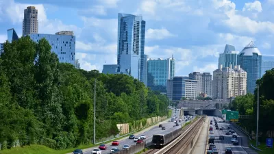
The project is part of MARTA’s effort to support more transit-oriented development in downtown Atlanta.
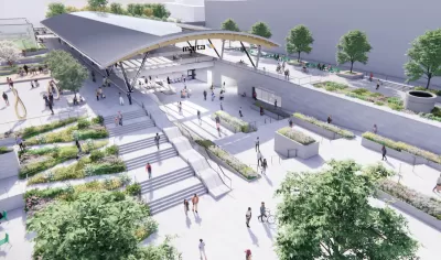
A massive redevelopment project at Atlanta’s Five Points Metropolitan Atlanta Rapid Transit Authority (MARTA) transit station is moving forward into a public review phase required under the National Environmental Policy Act (NEPA).
As Josh Green explains in Urbanize Atlanta, “The $206-million overhaul calls for removing and replacing Five Points station’s concrete canopy, reconnecting Broad Street to pedestrian traffic, adding customer amenities, and incorporating spaces for public art, agriculture, and communal gatherings.”
The project includes measures to mitigate negative impacts on the historically significant aspects of the station such as “architectural documentation such as photography and interpretive panels that memorialize today’s concourse and plaza levels.”
While the station overhaul won’t be complete before the 2026 World Cup games Atlanta is hosting, “The project is expected to help set the stage for transit-oriented development downtown, including a future residential component at Underground Atlanta.”
FULL STORY: MARTA's Five Points station redevelopment takes step forward


New TOD Breaks Ground in Atlanta Area
The project will include over 500 housing units, commercial and retail space, and park spaces.
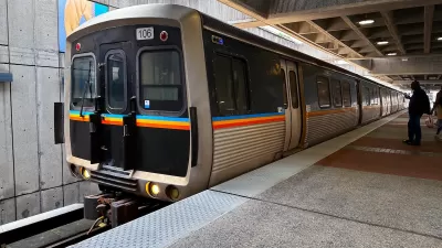
MARTA Adds Train Service for NYE Events
The Atlanta transit agency will run additional trains to accommodate traffic to sporting and cultural events downtown over the New Year’s holiday.
Atlanta City Leaders Call on MARTA to Expand Weekend Service
The city is set to host multiple major sporting events in the next several years, prompting calls for expanded transit service on weekends and to popular areas.

Maui's Vacation Rental Debate Turns Ugly
Verbal attacks, misinformation campaigns and fistfights plague a high-stakes debate to convert thousands of vacation rentals into long-term housing.

Planetizen Federal Action Tracker
A weekly monitor of how Trump’s orders and actions are impacting planners and planning in America.

San Francisco Suspends Traffic Calming Amidst Record Deaths
Citing “a challenging fiscal landscape,” the city will cease the program on the heels of 42 traffic deaths, including 24 pedestrians.

Half of Post-Fire Altadena Home Sales Were to Corporations
Large investors are quietly buying up dozens of properties in Altadena, California, where a devastating wildfire destroyed more than 6,000 homes in January.

Opinion: What San Francisco’s Proposed ‘Family Zoning’ Could Really Mean
Mayor Lurie is using ‘family zoning’ to encourage denser development and upzoning — but could the concept actually foster community and more human-scale public spaces?

Jacksonville Launches First Autonomous Transit Shuttle in US
A fleet of 14 fully autonomous vehicles will serve a 3.5-mile downtown Jacksonville route with 12 stops.
Urban Design for Planners 1: Software Tools
This six-course series explores essential urban design concepts using open source software and equips planners with the tools they need to participate fully in the urban design process.
Planning for Universal Design
Learn the tools for implementing Universal Design in planning regulations.
Gallatin County Department of Planning & Community Development
Heyer Gruel & Associates PA
JM Goldson LLC
City of Camden Redevelopment Agency
City of Astoria
Transportation Research & Education Center (TREC) at Portland State University
Jefferson Parish Government
Camden Redevelopment Agency
City of Claremont