


The Los Angeles County Board of Supervisors recently closed outdoor dining because of a sudden but rapid rise of coronavirus infections in the county.
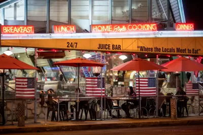
After the L.A. County Department of Health's order to shut down outdoor on-site dining facilities, restaurant owners and other food service workers want to know why their service is under fire while retail and gyms are allowed to stay open at a reduced capacity.
What data did the county Board of Supervisors consult when making this decision? Farley Elliott says that Los Angeles County, despite having a "fairly robust" contract-tracing program, has gathered data that are far from exhaustive and clean. The County has faced great difficulty in tracking cases with "10 million inhabitants, 31,000 restaurants, few mechanisms currently in place to limit individual travel, and no mandate to collect customer data at restaurants or points of retail," writes Elliott.
According to county officials, it is estimated that up to 15% of COVID cases can be traced to "dining experience," Elliott reports. UCLA associate professor of community health sciences and epidemiology Shira Shafir indicates that according to the contact tracking data, outdoor dining could contribute to the spread of the virus. Officials point to risk in any activity that requires people to gather, and especially those that require the removal of face coverings.
Elliot says that the county Board of Supervisors' decision to close outdoor dining has nothing to do with the causal data connecting specific activities to the spread of the virus. "Simply put, county officials agreed to shut down outdoor dining because coronavirus cases and hospitalizations have been rising dramatically over several weeks, and reducing the number of places where people gather — especially unmasked — is one of the levers of power available to them," opines Elliot.
FULL STORY: Where Is the Data to Support Closing Outdoor Dining in LA? It’s Complicated


Los Angeles Extends Outdoor Dining Program for Up to Three Years
An emergency ordinance signed by the city's mayor will allow restaurants to keep outdoor dining facilities built during the pandemic for at least one more year.

Winter Is Coming—Capitalize on It
Outdoor dining programs have provided relief for local restaurants and retailers, while offering an oasis of social life for residents. The winter months will challenge that momentum, but creative, flexible approaches can save the day again.

Seattle Extends Outdoor Dining for a Year, Eases Rules on Heaters for the Winter
Outdoor dining is going to hang out for a bit.

Planetizen Federal Action Tracker
A weekly monitor of how Trump’s orders and actions are impacting planners and planning in America.

The Simple Legislative Tool Transforming Vacant Downtowns
In California, Michigan and Georgia, an easy win is bringing dollars — and delight — back to city centers.

San Francisco's School District Spent $105M To Build Affordable Housing for Teachers — And That's Just the Beginning
SFUSD joins a growing list of school districts using their land holdings to address housing affordability challenges faced by their own employees.

In More Metros Than You’d Think, Suburbs are Now More Expensive Than the City
If you're moving to the burbs to save on square footage, data shows you should think again.

The States Losing Rural Delivery Rooms at an Alarming Pace
In some states, as few as 9% of rural hospitals still deliver babies. As a result, rising pre-term births, no adequate pre-term care and "harrowing" close calls are a growing reality.

The Small South Asian Republic Going all in on EVs
Thanks to one simple policy change less than five years ago, 65% of new cars in this Himalayan country are now electric.
Urban Design for Planners 1: Software Tools
This six-course series explores essential urban design concepts using open source software and equips planners with the tools they need to participate fully in the urban design process.
Planning for Universal Design
Learn the tools for implementing Universal Design in planning regulations.
Smith Gee Studio
City of Charlotte
City of Camden Redevelopment Agency
City of Astoria
Transportation Research & Education Center (TREC) at Portland State University
US High Speed Rail Association
City of Camden Redevelopment Agency
Municipality of Princeton (NJ)